

Further analysis on the classification accuracy with ground truth is made by using
the confusion matrix tool in ENVI software, which generates the producer accuracy,
the user accuracy, the overall accuracy, and Kappa coefficients (Cohen 1960). The
producer accuracy (PA) is a measure indicating the probability that the classifier has
labeled an image pixel into Class A given that the ground truth is Class A. User
accuracy (UA) is a measure indicating the probability that a pixel is Class A given
that the classifier has labeled the pixel into Class A.
Table 17.3 shows a summary of the classification accuracy assessment. From
Table 17.3, it can be found that the overall accuracies (OA) in 2011, 2007, and 1998
are all higher than 85%, while Kappa coefficients, κ, are greater than 0.8. For all
land-cover types, only the producer accuracies of saline land in 2007 and 1998 and
vegetation cover in 2007 are lower than 80%, which indicates this land-cover type is
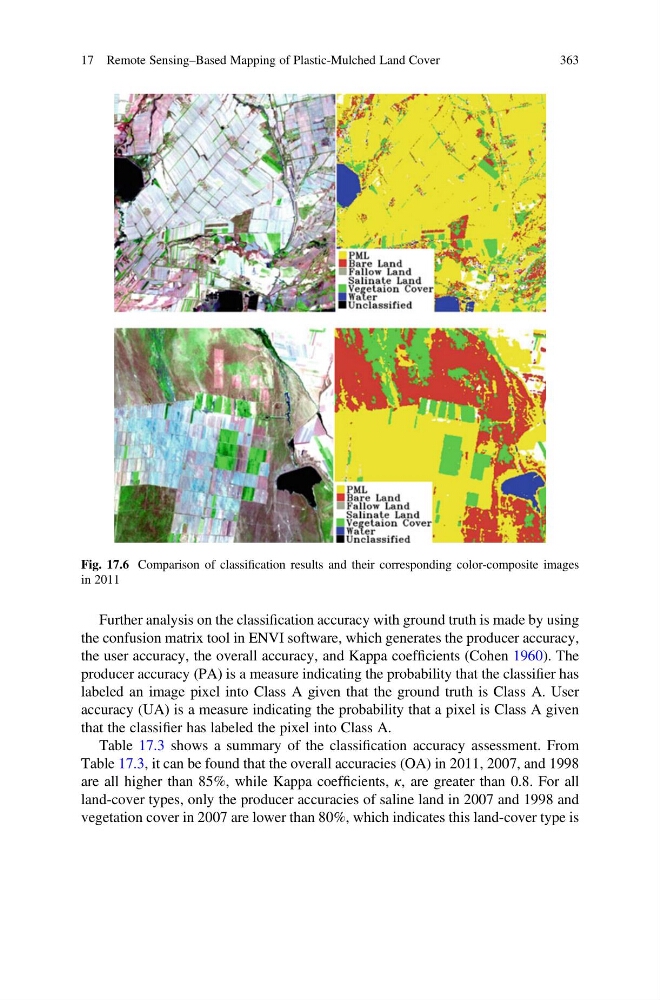
Fig. 17.6 Comparison of classification results and their corresponding color-composite images
in 2011
17 Remote Sensing–Based Mapping of Plastic-Mulched Land Cover
363
the confusion matrix tool in ENVI software, which generates the producer accuracy,
the user accuracy, the overall accuracy, and Kappa coefficients (Cohen 1960). The
producer accuracy (PA) is a measure indicating the probability that the classifier has
labeled an image pixel into Class A given that the ground truth is Class A. User
accuracy (UA) is a measure indicating the probability that a pixel is Class A given
that the classifier has labeled the pixel into Class A.
Table 17.3 shows a summary of the classification accuracy assessment. From
Table 17.3, it can be found that the overall accuracies (OA) in 2011, 2007, and 1998
are all higher than 85%, while Kappa coefficients, κ, are greater than 0.8. For all
land-cover types, only the producer accuracies of saline land in 2007 and 1998 and
vegetation cover in 2007 are lower than 80%, which indicates this land-cover type is
Fig. 17.6 Comparison of classification results and their corresponding color-composite images
in 2011
17 Remote Sensing–Based Mapping of Plastic-Mulched Land Cover
363