

control and advanced diagnostics for increasing the reliability and management of
the quality of service (QoS).
There are 34 sensors at each of the agrometeorological stations. By having these
sensors and dedicated fusion schemes, the stations enable the following systems:
• Agrometeorological data services
• Phenological stage monitoring
• Agricultural early warning system
• Automated mapping of plant water consumption
• Disease determination system
• Drought monitoring system
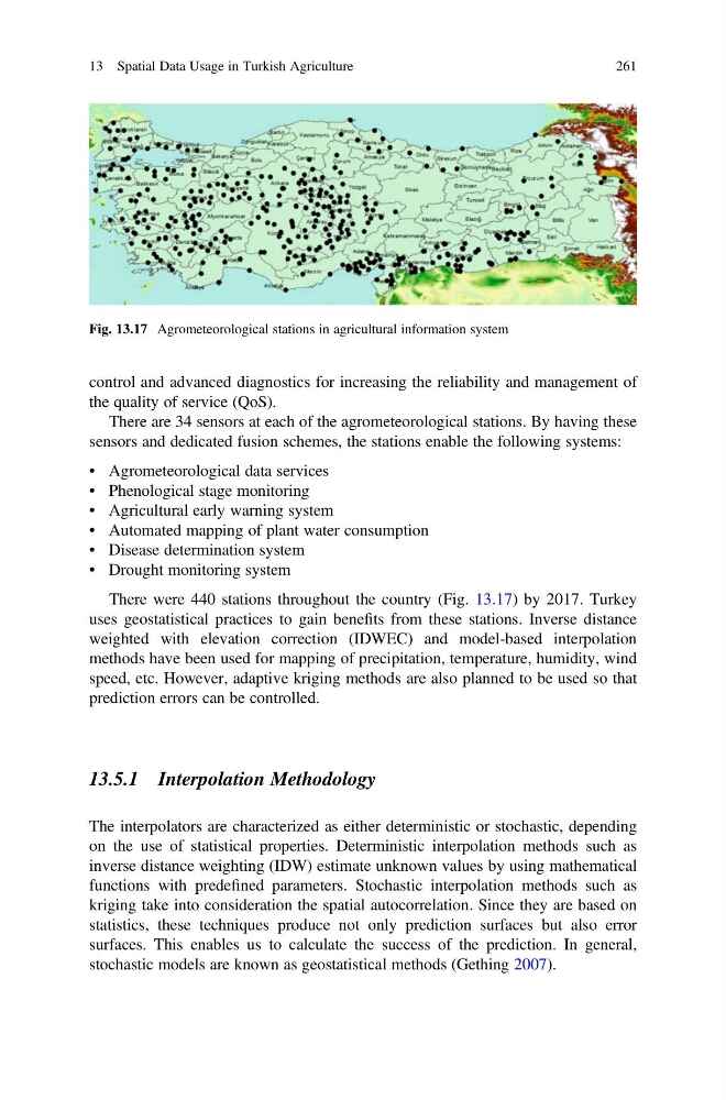
There were 440 stations throughout the country (Fig. 13.17) by 2017. Turkey
uses geostatistical practices to gain benefits from these stations. Inverse distance
weighted with elevation correction (IDWEC) and model-based interpolation
methods have been used for mapping of precipitation, temperature, humidity, wind
speed, etc. However, adaptive kriging methods are also planned to be used so that
prediction errors can be controlled.
13.5.1 Interpolation Methodology
The interpolators are characterized as either deterministic or stochastic, depending
on the use of statistical properties. Deterministic interpolation methods such as
inverse distance weighting (IDW) estimate unknown values by using mathematical
functions with predefined parameters. Stochastic interpolation methods such as
kriging take into consideration the spatial autocorrelation. Since they are based on
statistics, these techniques produce not only prediction surfaces but also error
surfaces. This enables us to calculate the success of the prediction. In general,
stochastic models are known as geostatistical methods (Gething 2007).
Fig. 13.17 Agrometeorological stations in agricultural information system
13 Spatial Data Usage in Turkish Agriculture
261
the quality of service (QoS).
There are 34 sensors at each of the agrometeorological stations. By having these
sensors and dedicated fusion schemes, the stations enable the following systems:
• Agrometeorological data services
• Phenological stage monitoring
• Agricultural early warning system
• Automated mapping of plant water consumption
• Disease determination system
• Drought monitoring system
There were 440 stations throughout the country (Fig. 13.17) by 2017. Turkey
uses geostatistical practices to gain benefits from these stations. Inverse distance
weighted with elevation correction (IDWEC) and model-based interpolation
methods have been used for mapping of precipitation, temperature, humidity, wind
speed, etc. However, adaptive kriging methods are also planned to be used so that
prediction errors can be controlled.
13.5.1 Interpolation Methodology
The interpolators are characterized as either deterministic or stochastic, depending
on the use of statistical properties. Deterministic interpolation methods such as
inverse distance weighting (IDW) estimate unknown values by using mathematical
functions with predefined parameters. Stochastic interpolation methods such as
kriging take into consideration the spatial autocorrelation. Since they are based on
statistics, these techniques produce not only prediction surfaces but also error
surfaces. This enables us to calculate the success of the prediction. In general,
stochastic models are known as geostatistical methods (Gething 2007).
Fig. 13.17 Agrometeorological stations in agricultural information system
13 Spatial Data Usage in Turkish Agriculture
261