

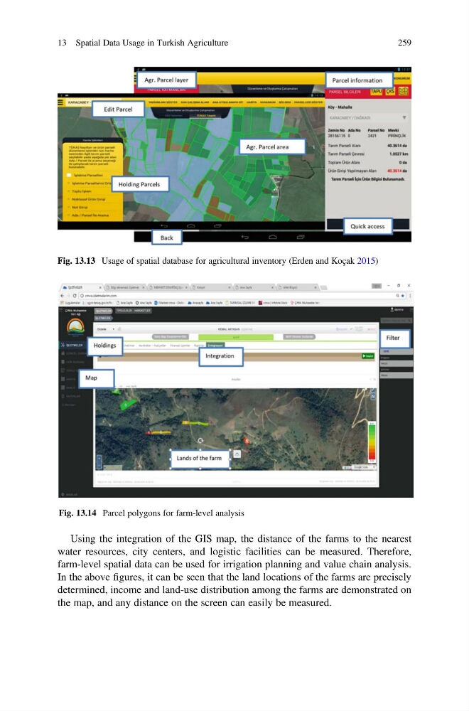
Using the integration of the GIS map, the distance of the farms to the nearest
water resources, city centers, and logistic facilities can be measured. Therefore,
farm-level spatial data can be used for irrigation planning and value chain analysis.
In the above figures, it can be seen that the land locations of the farms are precisely
determined, income and land-use distribution among the farms are demonstrated on
the map, and any distance on the screen can easily be measured.
Fig. 13.13 Usage of spatial database for agricultural inventory (Erden and Koçak 2015)
Fig. 13.14 Parcel polygons for farm-level analysis
13 Spatial Data Usage in Turkish Agriculture
259
water resources, city centers, and logistic facilities can be measured. Therefore,
farm-level spatial data can be used for irrigation planning and value chain analysis.
In the above figures, it can be seen that the land locations of the farms are precisely
determined, income and land-use distribution among the farms are demonstrated on
the map, and any distance on the screen can easily be measured.
Fig. 13.13 Usage of spatial database for agricultural inventory (Erden and Koçak 2015)
Fig. 13.14 Parcel polygons for farm-level analysis
13 Spatial Data Usage in Turkish Agriculture
259