

monitored US crop soil moisture condition using weekly field observations for
counties in 45 states. The state-level estimates are reported based on subjective
and qualitative field observations which are inaccurate and may be misleading (Yang
et al. 2017). The operation of SMAP mission provides another low-cost efficient
alternative solution to this USDA routine procedure. SMAP Explorer echoes this
idea and publishes the big processed soil moisture dataset via the web-based system.
The system is recently deployed online for test running and will become operational
after the test phase.
8.4.7 GeoFairy
Most agricultural application scenarios are in the farm fields. Farmers cannot carry
the large servers or laptops around when they are working. Mobile apps on smart
phones are perfect solution for farmers who want to directly retrieve geospatial
information about their real-time location. To meet that needs, we developed the
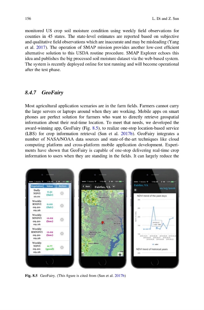
award-winning app, GeoFairy (Fig. 8.5), to realize one-stop location-based service
(LBS) for crop information retrieval (Sun et al. 2017b). GeoFairy integrates a
number of NASA/NOAA data sources and state-of-the-art techniques like cloud
computing platform and cross-platform mobile application development. Experiments have shown that GeoFairy is capable of one-stop delivering real-time crop
information to users when they are standing in the fields. It can largely reduce the
Fig. 8.5 GeoFairy. (This figure is cited from (Sun et al. 2017b)
156
L. Di and Z. Sun
counties in 45 states. The state-level estimates are reported based on subjective
and qualitative field observations which are inaccurate and may be misleading (Yang
et al. 2017). The operation of SMAP mission provides another low-cost efficient
alternative solution to this USDA routine procedure. SMAP Explorer echoes this
idea and publishes the big processed soil moisture dataset via the web-based system.
The system is recently deployed online for test running and will become operational
after the test phase.
8.4.7 GeoFairy
Most agricultural application scenarios are in the farm fields. Farmers cannot carry
the large servers or laptops around when they are working. Mobile apps on smart
phones are perfect solution for farmers who want to directly retrieve geospatial
information about their real-time location. To meet that needs, we developed the
award-winning app, GeoFairy (Fig. 8.5), to realize one-stop location-based service
(LBS) for crop information retrieval (Sun et al. 2017b). GeoFairy integrates a
number of NASA/NOAA data sources and state-of-the-art techniques like cloud
computing platform and cross-platform mobile application development. Experiments have shown that GeoFairy is capable of one-stop delivering real-time crop
information to users when they are standing in the fields. It can largely reduce the
Fig. 8.5 GeoFairy. (This figure is cited from (Sun et al. 2017b)
156
L. Di and Z. Sun