

8.4.4 VegScape
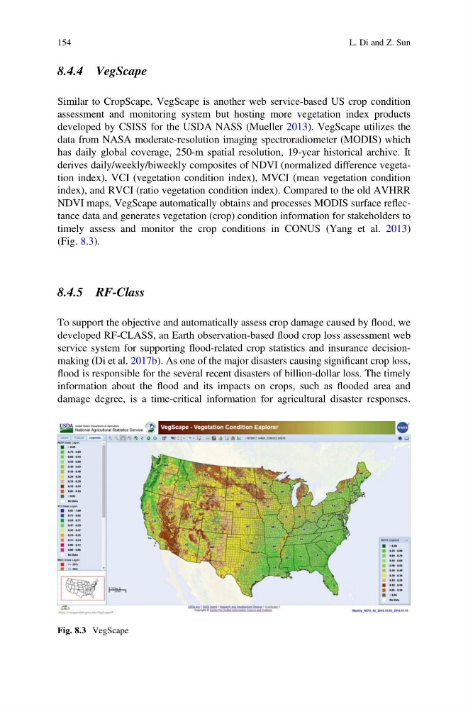
Similar to CropScape, VegScape is another web service-based US crop condition
assessment and monitoring system but hosting more vegetation index products
developed by CSISS for the USDA NASS (Mueller 2013). VegScape utilizes the
data from NASA moderate-resolution imaging spectroradiometer (MODIS) which
has daily global coverage, 250-m spatial resolution, 19-year historical archive. It
derives daily/weekly/biweekly composites of NDVI (normalized difference vegetation index), VCI (vegetation condition index), MVCI (mean vegetation condition
index), and RVCI (ratio vegetation condition index). Compared to the old AVHRR
NDVI maps, VegScape automatically obtains and processes MODIS surface reflectance data and generates vegetation (crop) condition information for stakeholders to
timely assess and monitor the crop conditions in CONUS (Yang et al. 2013)
(Fig. 8.3).
8.4.5 RF-Class
To support the objective and automatically assess crop damage caused by flood, we
developed RF-CLASS, an Earth observation-based flood crop loss assessment web
service system for supporting flood-related crop statistics and insurance decisionmaking (Di et al. 2017b). As one of the major disasters causing significant crop loss,
flood is responsible for the several recent disasters of billion-dollar loss. The timely
information about the flood and its impacts on crops, such as flooded area and
damage degree, is a time-critical information for agricultural disaster responses.
Fig. 8.3 VegScape
154
L. Di and Z. Sun
Similar to CropScape, VegScape is another web service-based US crop condition
assessment and monitoring system but hosting more vegetation index products
developed by CSISS for the USDA NASS (Mueller 2013). VegScape utilizes the
data from NASA moderate-resolution imaging spectroradiometer (MODIS) which
has daily global coverage, 250-m spatial resolution, 19-year historical archive. It
derives daily/weekly/biweekly composites of NDVI (normalized difference vegetation index), VCI (vegetation condition index), MVCI (mean vegetation condition
index), and RVCI (ratio vegetation condition index). Compared to the old AVHRR
NDVI maps, VegScape automatically obtains and processes MODIS surface reflectance data and generates vegetation (crop) condition information for stakeholders to
timely assess and monitor the crop conditions in CONUS (Yang et al. 2013)
(Fig. 8.3).
8.4.5 RF-Class
To support the objective and automatically assess crop damage caused by flood, we
developed RF-CLASS, an Earth observation-based flood crop loss assessment web
service system for supporting flood-related crop statistics and insurance decisionmaking (Di et al. 2017b). As one of the major disasters causing significant crop loss,
flood is responsible for the several recent disasters of billion-dollar loss. The timely
information about the flood and its impacts on crops, such as flooded area and
damage degree, is a time-critical information for agricultural disaster responses.
Fig. 8.3 VegScape
154
L. Di and Z. Sun