

those of oceanographic interests (Parke et al.,
1987). The best ocean tide models derived from the
T/P data are accurate with an rms error of 2–3 cm
(Le Provost, 2000) in the open ocean. This is by
itself a major accomplishment. For the first time
the knowledge of ocean tides, a major component
of the fluctuating ocean currents, is available everywhere in the open ocean. On the other hand, this
knowledge allows the removal of tidal signals from
altimetry data with an accuracy comparable to the
altimeter measurement accuracy. The residual tidal
signals appear in the corresponding aliased periods
such as 62 days for the M 2 component, and 173
days for the K 1 component in the T/P data. Because
the aliased tidal periods are precisely known (Le
Provost, 2000), these residual errors will not affect
the study of ocean circulation in a significant way
if the aliased periods do not coincide with those of
strong ocean variability. However, the aliased
period of K 1 , 173 days, is very close to the semiannual period and could be problematic in regions
where the semiannual variability is strong, such as
the South Atlantic and the central tropical Pacific
(Jacobs et al., 1992). In the tropical regions, especially in the Indian Ocean where the ocean has substantial variability at periods near 60 days (Luyten
and Roemmich, 1982; Kindle and Thompson,
1989), the M 2 tidal aliasing also presents a problem. Because the phase of the tides are sampled
differently by adjacent satellite tracks, aliased tidal
signals may appear as travelling waves and create
confusions for interpretation (e.g. Chelton et al.,
2000).
With the performance of T/P, we are able to
determine the first two terms of equation (3.3.1)
within a few centimetres over the global ocean
every 10 days. We still need accurate geoid models
to derive ocean topography from altimetric observations. The accuracy of the present geoid models,
however, has not yet matched the accuracy of satellite altimetry, making the derived ocean topography not sufficiently accurate for determining the
details of the absolute ocean circulation. This deficiency has long been recognized by the geodynamics community (National Research Council, 1997).
New missions such as GRACE (Gravity Recovery
and Climate Experiment) (Wahr et al., 1998; Davis
et al., 1999) and GOCE (Gravity Field and SteadyState Ocean Circulation Explorer) (LeGrand and
Minster, 1999) have been planned to obtain more
accurate measurement of the earth’s gravity field
and hence the knowledge of the geoid. However, at
wavelengths longer than 3000 km, the errors of the
geoid models presently available are below the level
of oceanographic signals. At these large scales, satellite altimetry has provided the first direct measurement of the ocean topography. The utility of such
measurement for the determination of the oceanic
general circulation is discussed in Section 3.3.2.
Without detailed knowledge of the geoid, satellite
altimetry data have primarily been used to study
the temporal variability of the ocean. Because the
temporal variability of the geoid is negligibly small
when compared to that of the ocean, sea surface
height measured along precisely repeating ground
tracks or at ground-track cross-overs is used to
compute the temporal change of the ocean. Studies
based on early altimetry missions have to deal
with a host of errors from orbit uncertainties, poor
corrections for the atmospheric effects, and
inaccurate knowledge of the tides (e.g. Wunsch
and Gaposchkin, 1980; Fu, 1983; Fu and Cheney,
1995). These errors have often limited the utility of
altimetry to the study of the energetic mesoscale
eddies and boundary currents. T/P is the first altimetry mission that produces data sufficiently accurate
for studying variabilities on scales larger than the
mesoscale without the need for correcting large-scale
errors at the expense of distorting signals. This data
set has led to many new discoveries at the large
scales where conventional in-situ measurements suffer from inadequate sampling. Results from studies
focused on the large scales (larger than the mesoscale, whose upper bound is loosely defined as
500 km) are discussed in Section 3.3.3. Results on
smaller-scale variabilities, including mesoscale eddies
and ocean currents whose cross-current scales are
less than 500 km, are discussed in Section 3.3.4.
Concluding discussions and future perspectives are
given in Section 3.3.5. The reader should note that a
substantial portion of Sections 3.3.2 and 3.3.3 is
adapted from Fu and Chelton (2000).
3.3.2 The ocean general circulation
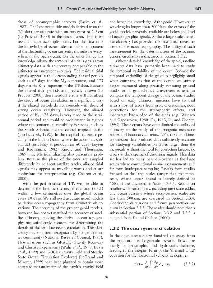
In the open ocean a few hundred km away from
the equator, the large-scale oceanic flows are
nearly in geostrophic and hydrostatic balance,
leading to the integral form of the ‘thermal wind’
equation for the horizontal velocity at depth z:
v(z): ͵
z
z
0
dz;v 0
(3.3.2)
Ѩ
ᎏ
Ѩx
g
ᎏ
f
3.3 Ocean Circulation and Variability from Satellite Altimetry
143
Fu
1987). The best ocean tide models derived from the
T/P data are accurate with an rms error of 2–3 cm
(Le Provost, 2000) in the open ocean. This is by
itself a major accomplishment. For the first time
the knowledge of ocean tides, a major component
of the fluctuating ocean currents, is available everywhere in the open ocean. On the other hand, this
knowledge allows the removal of tidal signals from
altimetry data with an accuracy comparable to the
altimeter measurement accuracy. The residual tidal
signals appear in the corresponding aliased periods
such as 62 days for the M 2 component, and 173
days for the K 1 component in the T/P data. Because
the aliased tidal periods are precisely known (Le
Provost, 2000), these residual errors will not affect
the study of ocean circulation in a significant way
if the aliased periods do not coincide with those of
strong ocean variability. However, the aliased
period of K 1 , 173 days, is very close to the semiannual period and could be problematic in regions
where the semiannual variability is strong, such as
the South Atlantic and the central tropical Pacific
(Jacobs et al., 1992). In the tropical regions, especially in the Indian Ocean where the ocean has substantial variability at periods near 60 days (Luyten
and Roemmich, 1982; Kindle and Thompson,
1989), the M 2 tidal aliasing also presents a problem. Because the phase of the tides are sampled
differently by adjacent satellite tracks, aliased tidal
signals may appear as travelling waves and create
confusions for interpretation (e.g. Chelton et al.,
2000).
With the performance of T/P, we are able to
determine the first two terms of equation (3.3.1)
within a few centimetres over the global ocean
every 10 days. We still need accurate geoid models
to derive ocean topography from altimetric observations. The accuracy of the present geoid models,
however, has not yet matched the accuracy of satellite altimetry, making the derived ocean topography not sufficiently accurate for determining the
details of the absolute ocean circulation. This deficiency has long been recognized by the geodynamics community (National Research Council, 1997).
New missions such as GRACE (Gravity Recovery
and Climate Experiment) (Wahr et al., 1998; Davis
et al., 1999) and GOCE (Gravity Field and SteadyState Ocean Circulation Explorer) (LeGrand and
Minster, 1999) have been planned to obtain more
accurate measurement of the earth’s gravity field
and hence the knowledge of the geoid. However, at
wavelengths longer than 3000 km, the errors of the
geoid models presently available are below the level
of oceanographic signals. At these large scales, satellite altimetry has provided the first direct measurement of the ocean topography. The utility of such
measurement for the determination of the oceanic
general circulation is discussed in Section 3.3.2.
Without detailed knowledge of the geoid, satellite
altimetry data have primarily been used to study
the temporal variability of the ocean. Because the
temporal variability of the geoid is negligibly small
when compared to that of the ocean, sea surface
height measured along precisely repeating ground
tracks or at ground-track cross-overs is used to
compute the temporal change of the ocean. Studies
based on early altimetry missions have to deal
with a host of errors from orbit uncertainties, poor
corrections for the atmospheric effects, and
inaccurate knowledge of the tides (e.g. Wunsch
and Gaposchkin, 1980; Fu, 1983; Fu and Cheney,
1995). These errors have often limited the utility of
altimetry to the study of the energetic mesoscale
eddies and boundary currents. T/P is the first altimetry mission that produces data sufficiently accurate
for studying variabilities on scales larger than the
mesoscale without the need for correcting large-scale
errors at the expense of distorting signals. This data
set has led to many new discoveries at the large
scales where conventional in-situ measurements suffer from inadequate sampling. Results from studies
focused on the large scales (larger than the mesoscale, whose upper bound is loosely defined as
500 km) are discussed in Section 3.3.3. Results on
smaller-scale variabilities, including mesoscale eddies
and ocean currents whose cross-current scales are
less than 500 km, are discussed in Section 3.3.4.
Concluding discussions and future perspectives are
given in Section 3.3.5. The reader should note that a
substantial portion of Sections 3.3.2 and 3.3.3 is
adapted from Fu and Chelton (2000).
3.3.2 The ocean general circulation
In the open ocean a few hundred km away from
the equator, the large-scale oceanic flows are
nearly in geostrophic and hydrostatic balance,
leading to the integral form of the ‘thermal wind’
equation for the horizontal velocity at depth z:
v(z): ͵
z
z
0
dz;v 0
(3.3.2)
Ѩ
ᎏ
Ѩx
g
ᎏ
f
3.3 Ocean Circulation and Variability from Satellite Altimetry
143
Fu