

5.3 PRIMARY INORGANIC SEDIMENTARY STRUCTURES
139
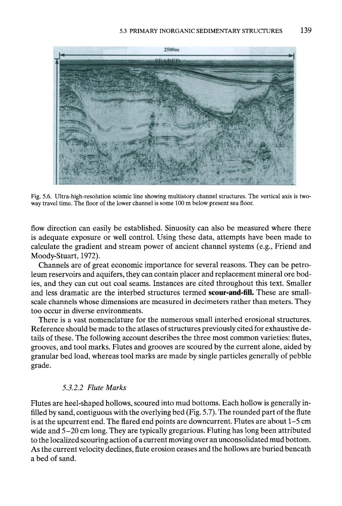
Fig. 5.6. Ultra-high-resolution seismic line showing multistory channel structures. The vertical axis is twoway travel time. The floor of the lower channel is some 100 m below present sea floor.
flow direction can easily be established. Sinuosity can also be measured where there
is adequate exposure or well control. Using these data, attempts have been made to
calculate the gradient and stream power of ancient channel systems (e.g., Friend and
Moody-Stuart, 1972).
Channels are of great economic importance for several reasons. They can be petroleum reservoirs and aquifers, they can contain placer and replacement mineral ore bodies, and they can cut out coal seams. Instances are cited throughout this text. Smaller
and less dramatic are the interbed structures termed scour-and-fill. These are smallscale channels whose dimensions are measured in decimeters rather than meters. They
too occur in diverse environments.
There is a vast nomenclature for the numerous small interbed erosional structures.
Reference should be made to the atlases of structures previously cited for exhaustive details of these. The following account describes the three most common varieties: flutes,
grooves, and tool marks. Flutes and grooves are scoured by the current alone, aided by
granular bed load, whereas tool marks are made by single particles generally of pebble
grade.
5.3.2.2 Flute Marks
Flutes are heel-shaped hollows, scoured into mud bottoms. Each hollow is generally infilled by sand, contiguous with the overlying bed (Fig. 5.7). The rounded part of the flute
is at the upcurrent end. The flared end points are downcurrent. Flutes are about 1-5 cm
wide and 5-20 cm long. They are typically gregarious. Fluting has long been attributed
to the localized scouring action of a current moving over an unconsolidated mud bottom.
As the current velocity declines, flute erosion ceases and the hollows are buried beneath
a bed of sand.
139
Fig. 5.6. Ultra-high-resolution seismic line showing multistory channel structures. The vertical axis is twoway travel time. The floor of the lower channel is some 100 m below present sea floor.
flow direction can easily be established. Sinuosity can also be measured where there
is adequate exposure or well control. Using these data, attempts have been made to
calculate the gradient and stream power of ancient channel systems (e.g., Friend and
Moody-Stuart, 1972).
Channels are of great economic importance for several reasons. They can be petroleum reservoirs and aquifers, they can contain placer and replacement mineral ore bodies, and they can cut out coal seams. Instances are cited throughout this text. Smaller
and less dramatic are the interbed structures termed scour-and-fill. These are smallscale channels whose dimensions are measured in decimeters rather than meters. They
too occur in diverse environments.
There is a vast nomenclature for the numerous small interbed erosional structures.
Reference should be made to the atlases of structures previously cited for exhaustive details of these. The following account describes the three most common varieties: flutes,
grooves, and tool marks. Flutes and grooves are scoured by the current alone, aided by
granular bed load, whereas tool marks are made by single particles generally of pebble
grade.
5.3.2.2 Flute Marks
Flutes are heel-shaped hollows, scoured into mud bottoms. Each hollow is generally infilled by sand, contiguous with the overlying bed (Fig. 5.7). The rounded part of the flute
is at the upcurrent end. The flared end points are downcurrent. Flutes are about 1-5 cm
wide and 5-20 cm long. They are typically gregarious. Fluting has long been attributed
to the localized scouring action of a current moving over an unconsolidated mud bottom.
As the current velocity declines, flute erosion ceases and the hollows are buried beneath
a bed of sand.