

44
Chapter 2 Where in the Geospatial World Are You?
Like the UTM conversion tool in Hands-on Application 2.3: Converting from Latitude/Longitude to
UTM, there are Web-based utilities used to convert
GCS coordinates into their SPCS counterparts. A
good one is set up by NOAA and available at http://
www.ngs.noaa.gov/cgi-bin/spc_getpc.prl. Similar
to the utility used in Hands-on Application 2.3, this
Web resource enables you to enter the latitude and
longitude of a location and it will calculate the SPCS
coordinates for that point. Note that the lat/long
you give it have to be formatted in a specific way
(see the example on the Website for more details)
in order for it to work properly. Use Web resources
or other mapping data you may have available to
you to find lat/long coordinates of some national
points of interest (such as the Transamerica Pyramid in California) and places more local to you and
calculate the SPCS coordinates for them. Be careful
to keep in mind the datum with which you’re working for the lat/long coordinates and also that SPCS
coordinates are available only for places within the
United States.
Hands-on Application 2.4
Using the State Plane Coordinate System
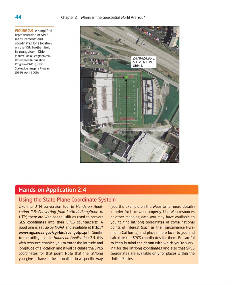
FIGURE 2.9 A simplified
representation of SPCS
measurements and
coordinates for a location
on the YSU football field
in Youngstown, Ohio.
(Source: Ohio Geographically
Referenced Information
Program (OGRIP), Ohio
Statewide Imagery Program
(OSIP), April 2006)
2478424.96 E,
531216.13N,
Ohio, N
Chapter 2 Where in the Geospatial World Are You?
Like the UTM conversion tool in Hands-on Application 2.3: Converting from Latitude/Longitude to
UTM, there are Web-based utilities used to convert
GCS coordinates into their SPCS counterparts. A
good one is set up by NOAA and available at http://
www.ngs.noaa.gov/cgi-bin/spc_getpc.prl. Similar
to the utility used in Hands-on Application 2.3, this
Web resource enables you to enter the latitude and
longitude of a location and it will calculate the SPCS
coordinates for that point. Note that the lat/long
you give it have to be formatted in a specific way
(see the example on the Website for more details)
in order for it to work properly. Use Web resources
or other mapping data you may have available to
you to find lat/long coordinates of some national
points of interest (such as the Transamerica Pyramid in California) and places more local to you and
calculate the SPCS coordinates for them. Be careful
to keep in mind the datum with which you’re working for the lat/long coordinates and also that SPCS
coordinates are available only for places within the
United States.
Hands-on Application 2.4
Using the State Plane Coordinate System
FIGURE 2.9 A simplified
representation of SPCS
measurements and
coordinates for a location
on the YSU football field
in Youngstown, Ohio.
(Source: Ohio Geographically
Referenced Information
Program (OGRIP), Ohio
Statewide Imagery Program
(OSIP), April 2006)
2478424.96 E,
531216.13N,
Ohio, N