

468
Chapter 15 What’s Next for Geospatial Technology?
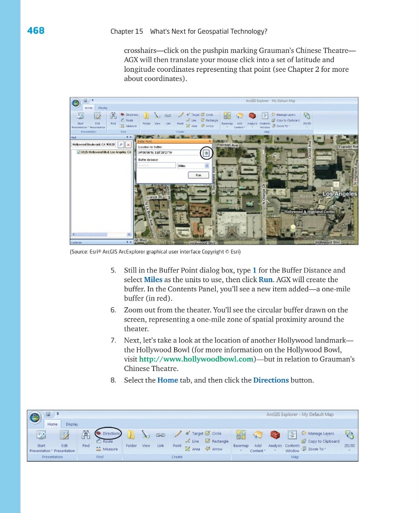
crosshairs—click on the pushpin marking Grauman’s Chinese Theatre—
AGX will then translate your mouse click into a set of latitude and
longitude coordinates representing that point (see Chapter 2 for more
about coordinates).
5. Still in the Buffer Point dialog box, type 1 for the Buffer Distance and
select Miles as the units to use, then click Run. AGX will create the
buffer. In the Contents Panel, you’ll see a new item added—a one-mile
buffer (in red).
6. Zoom out from the theater. You’ll see the circular buffer drawn on the
screen, representing a one-mile zone of spatial proximity around the
theater.
7. Next, let’s take a look at the location of another Hollywood landmark—
the Hollywood Bowl (for more information on the Hollywood Bowl,
visit http://www.hollywoodbowl.com)—but in relation to Grauman’s
Chinese Theatre.
8. Select the Home tab, and then click the Directions button.
(Source: Esri® ArcGIS ArcExplorer graphical user interface Copyright © Esri)
Chapter 15 What’s Next for Geospatial Technology?
crosshairs—click on the pushpin marking Grauman’s Chinese Theatre—
AGX will then translate your mouse click into a set of latitude and
longitude coordinates representing that point (see Chapter 2 for more
about coordinates).
5. Still in the Buffer Point dialog box, type 1 for the Buffer Distance and
select Miles as the units to use, then click Run. AGX will create the
buffer. In the Contents Panel, you’ll see a new item added—a one-mile
buffer (in red).
6. Zoom out from the theater. You’ll see the circular buffer drawn on the
screen, representing a one-mile zone of spatial proximity around the
theater.
7. Next, let’s take a look at the location of another Hollywood landmark—
the Hollywood Bowl (for more information on the Hollywood Bowl,
visit http://www.hollywoodbowl.com)—but in relation to Grauman’s
Chinese Theatre.
8. Select the Home tab, and then click the Directions button.
(Source: Esri® ArcGIS ArcExplorer graphical user interface Copyright © Esri)