

453
What Are Some Other Cool Developments in Geospatial Technology?
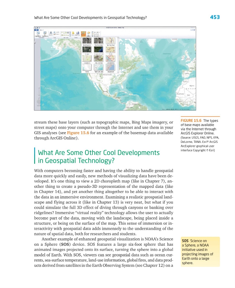
stream these base layers (such as topographic maps, Bing Maps imagery, or
street maps) onto your computer through the Internet and use them in your
GIS analyses (see Figure 15.6 for an example of the basemap data available
through ArcGIS Online).
What Are Some Other Cool Developments
in Geospatial Technology?
With computers becoming faster and having the ability to handle geospatial
data more quickly and easily, new methods of visualizing data have been developed. It’s one thing to view a 2D choropleth map (like in Chapter 7), another thing to create a pseudo-3D representation of the mapped data (like
in Chapter 14), and yet another thing altogether to be able to interact with
the data in an immersive environment. Examining a realistic geospatial landscape and flying across it (like in Chapter 13) is very neat, but what if you
could simulate the full 3D effect of diving through canyons or banking over
ridgelines? Immersive “virtual reality” technology allows the user to actually
become part of the data, moving with the landscape, being placed inside a
structure, or being on the surface of the map. This sense of immersion or interactivity with geospatial data adds immensely to the understanding of the
nature of spatial data, both for researchers and students.
Another example of enhanced geospatial visualization is NOAA’s Science
on a Sphere (SOS) device. SOS features a large six-foot sphere that has
animated images projected onto its surface, turning the sphere into a global
model of Earth. With SOS, viewers can see geospatial data such as ocean currents, sea-surface temperature, land-use information, global fires, and data products derived from satellites in the Earth Observing System (see Chapter 12) on a
FIGURE 15.6 The types
of base maps available
via the Internet through
ArcGIS Explorer Online.
(Source: USGS, FAO, NPS, EPA,
DeLorme, TANA. Esri® ArcGIS
ArcExplorer graphical user
interface Copyright © Esri)
SOS Science on
a Sphere, a NOAA
initiative used in
projecting images of
Earth onto a large
sphere.
What Are Some Other Cool Developments in Geospatial Technology?
stream these base layers (such as topographic maps, Bing Maps imagery, or
street maps) onto your computer through the Internet and use them in your
GIS analyses (see Figure 15.6 for an example of the basemap data available
through ArcGIS Online).
What Are Some Other Cool Developments
in Geospatial Technology?
With computers becoming faster and having the ability to handle geospatial
data more quickly and easily, new methods of visualizing data have been developed. It’s one thing to view a 2D choropleth map (like in Chapter 7), another thing to create a pseudo-3D representation of the mapped data (like
in Chapter 14), and yet another thing altogether to be able to interact with
the data in an immersive environment. Examining a realistic geospatial landscape and flying across it (like in Chapter 13) is very neat, but what if you
could simulate the full 3D effect of diving through canyons or banking over
ridgelines? Immersive “virtual reality” technology allows the user to actually
become part of the data, moving with the landscape, being placed inside a
structure, or being on the surface of the map. This sense of immersion or interactivity with geospatial data adds immensely to the understanding of the
nature of spatial data, both for researchers and students.
Another example of enhanced geospatial visualization is NOAA’s Science
on a Sphere (SOS) device. SOS features a large six-foot sphere that has
animated images projected onto its surface, turning the sphere into a global
model of Earth. With SOS, viewers can see geospatial data such as ocean currents, sea-surface temperature, land-use information, global fires, and data products derived from satellites in the Earth Observing System (see Chapter 12) on a
FIGURE 15.6 The types
of base maps available
via the Internet through
ArcGIS Explorer Online.
(Source: USGS, FAO, NPS, EPA,
DeLorme, TANA. Esri® ArcGIS
ArcExplorer graphical user
interface Copyright © Esri)
SOS Science on
a Sphere, a NOAA
initiative used in
projecting images of
Earth onto a large
sphere.