

448
Chapter 15 What’s Next for Geospatial Technology?
previous chapters allow you to specify a geographic area and then download
multiple datasets that cover that one area. For instance, if you’re studying East
Liverpool, Ohio, Web resources like the Seamless Server (from Chapter 13) or
EarthExplorer (from Chapters 5 and 9) allow you to select many types of data,
including remotely sensed imagery, land-cover data, elevation data, and road
networks of East Liverpool.
The Seamless Server is only one component of a much larger geospatial
data distribution program called the National Map. Users of the National
Map can access multiple types of datasets, including elevation, hydrography,
transportation, land-cover data, boundary files, and more, all in formats readable by GIS software. The National Map is part of larger National Geospatial
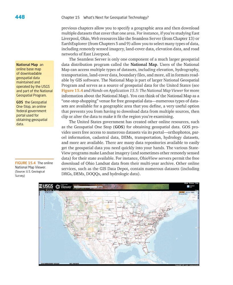
Program and serves as a source of geospatial data for the United States (see
Figure 15.4 and Hands-on Application 15.5: The National Map Viewer for more
information about the National Map). You can think of the National Map as a
“one-stop-shopping” venue for free geospatial data—numerous types of datasets are available for a geographic area that you define, a very useful option
that prevents you from having to download data from multiple sources, then
clip or alter the data to make it fit the region you’re examining.
The United States government has created other online resources, such
as the Geospatial One Stop (GOS) for obtaining geospatial data. GOS provides users free access to numerous datasets via its portal—orthophotos, parcel information, cadastral data, DEMs, transportation, hydrology datasets,
and more are available. There are many data repositories available to easily
get the geospatial data you need quickly into your hands. The various StateView programs make Landsat imagery (and sometimes other remotely sensed
data) for their state available. For instance, OhioView servers permit the free
download of Ohio Landsat data from their multi-year archive. Other online
services, such as the GIS Data Depot, contain numerous datasets (including
DRGs, DEMs, DOQQs, and hydrologic data).
National Map an
online base map
of downloadable
geospatial data
maintained and
operated by the USGS
and part of the National
Geospatial Program.
GOS the Geospatial
One-Stop, an online
federal government
portal used for
obtaining geospatial
data.
FIGURE 15.4 The online
National Map Viewer.
(Source: U.S. Geological
Survey)
Chapter 15 What’s Next for Geospatial Technology?
previous chapters allow you to specify a geographic area and then download
multiple datasets that cover that one area. For instance, if you’re studying East
Liverpool, Ohio, Web resources like the Seamless Server (from Chapter 13) or
EarthExplorer (from Chapters 5 and 9) allow you to select many types of data,
including remotely sensed imagery, land-cover data, elevation data, and road
networks of East Liverpool.
The Seamless Server is only one component of a much larger geospatial
data distribution program called the National Map. Users of the National
Map can access multiple types of datasets, including elevation, hydrography,
transportation, land-cover data, boundary files, and more, all in formats readable by GIS software. The National Map is part of larger National Geospatial
Program and serves as a source of geospatial data for the United States (see
Figure 15.4 and Hands-on Application 15.5: The National Map Viewer for more
information about the National Map). You can think of the National Map as a
“one-stop-shopping” venue for free geospatial data—numerous types of datasets are available for a geographic area that you define, a very useful option
that prevents you from having to download data from multiple sources, then
clip or alter the data to make it fit the region you’re examining.
The United States government has created other online resources, such
as the Geospatial One Stop (GOS) for obtaining geospatial data. GOS provides users free access to numerous datasets via its portal—orthophotos, parcel information, cadastral data, DEMs, transportation, hydrology datasets,
and more are available. There are many data repositories available to easily
get the geospatial data you need quickly into your hands. The various StateView programs make Landsat imagery (and sometimes other remotely sensed
data) for their state available. For instance, OhioView servers permit the free
download of Ohio Landsat data from their multi-year archive. Other online
services, such as the GIS Data Depot, contain numerous datasets (including
DRGs, DEMs, DOQQs, and hydrologic data).
National Map an
online base map
of downloadable
geospatial data
maintained and
operated by the USGS
and part of the National
Geospatial Program.
GOS the Geospatial
One-Stop, an online
federal government
portal used for
obtaining geospatial
data.
FIGURE 15.4 The online
National Map Viewer.
(Source: U.S. Geological
Survey)