

423
3D Modeling and Visualization
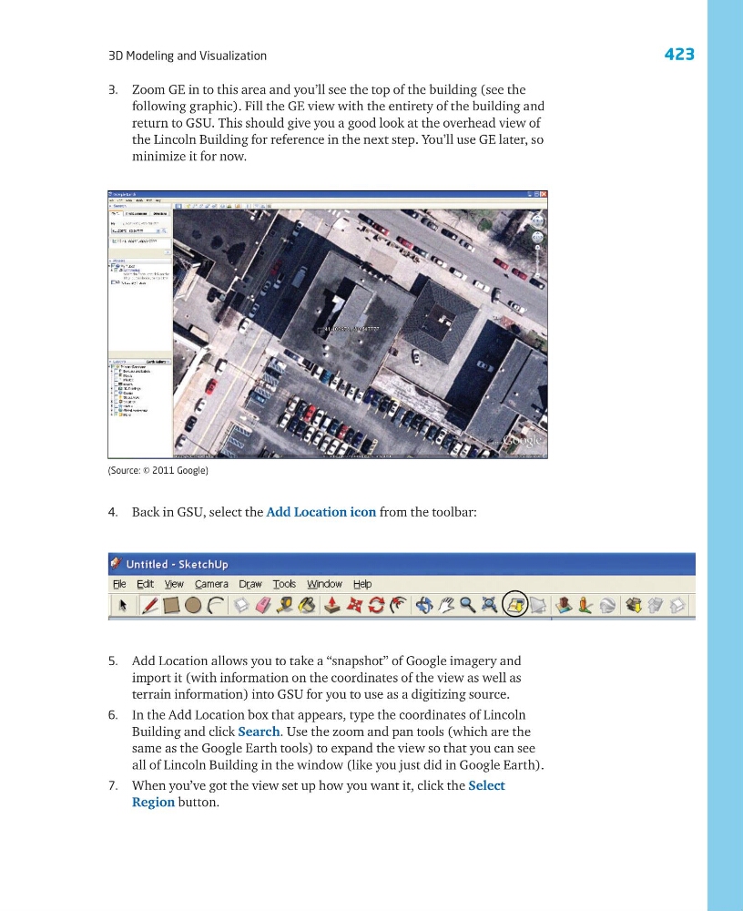
3. Zoom GE in to this area and you’ll see the top of the building (see the
following graphic). Fill the GE view with the entirety of the building and
return to GSU. This should give you a good look at the overhead view of
the Lincoln Building for reference in the next step. You’ll use GE later, so
minimize it for now.
4. Back in GSU, select the Add Location icon from the toolbar:
5. Add Location allows you to take a “snapshot” of Google imagery and
import it (with information on the coordinates of the view as well as
terrain information) into GSU for you to use as a digitizing source.
6. In the Add Location box that appears, type the coordinates of Lincoln
Building and click Search. Use the zoom and pan tools (which are the
same as the Google Earth tools) to expand the view so that you can see
all of Lincoln Building in the window (like you just did in Google Earth).
7. When you’ve got the view set up how you want it, click the Select
Region button.
(Source: © 2011 Google)
3D Modeling and Visualization
3. Zoom GE in to this area and you’ll see the top of the building (see the
following graphic). Fill the GE view with the entirety of the building and
return to GSU. This should give you a good look at the overhead view of
the Lincoln Building for reference in the next step. You’ll use GE later, so
minimize it for now.
4. Back in GSU, select the Add Location icon from the toolbar:
5. Add Location allows you to take a “snapshot” of Google imagery and
import it (with information on the coordinates of the view as well as
terrain information) into GSU for you to use as a digitizing source.
6. In the Add Location box that appears, type the coordinates of Lincoln
Building and click Search. Use the zoom and pan tools (which are the
same as the Google Earth tools) to expand the view so that you can see
all of Lincoln Building in the window (like you just did in Google Earth).
7. When you’ve got the view set up how you want it, click the Select
Region button.
(Source: © 2011 Google)