

408
Chapter 14 See the World in 3D
the difference between a regular extruded block and an extruded block that
has been offset from the surface.
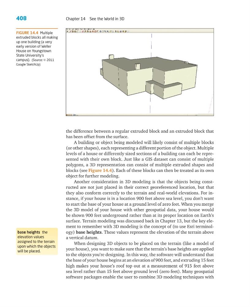
A building or object being modeled will likely consist of multiple blocks
(or other shapes), each representing a different portion of the object. Multiple
levels of a house or differently sized sections of a building can each be represented with their own block. Just like a GIS dataset can consist of multiple
polygons, a 3D representation can consist of multiple extruded shapes and
blocks (see Figure 14.4). Each of these blocks can then be treated as its own
object for further modeling.
Another consideration in 3D modeling is that the objects being constructed are not just placed in their correct georeferenced location, but that
they also conform correctly to the terrain and real-world elevations. For instance, if your house is in a location 900 feet above sea level, you don’t want
to start the base of your house at a ground level of zero feet. When you merge
the 3D model of your house with other geospatial data, your house would
be shown 900 feet underground rather than at its proper location on Earth’s
surface. Terrain modeling was discussed back in Chapter 13, but the key element to remember with 3D modeling is the concept of (to use Esri terminology) base heights. These values represent the elevation of the terrain above
a vertical datum.
When designing 3D objects to be placed on the terrain (like a model of
your house), you want to make sure that the terrain’s base heights are applied
to the objects you’re designing. In this way, the software will understand that
the base of your house begins at an elevation of 900 feet, and extruding 15 feet
high makes your house’s roof top out at a measurement of 915 feet above
sea level rather than 15 feet above ground level (zero feet). Many geospatial
software packages enable the user to combine 3D modeling techniques with
base heights the
elevation values
assigned to the terrain
upon which the objects
will be placed.
FIGURE 14.4 Multiple
extruded blocks all making
up one building (a very
early version of Weller
House on Youngstown
State University’s
campus). (Source: © 2011
Google SketchUp)
Chapter 14 See the World in 3D
the difference between a regular extruded block and an extruded block that
has been offset from the surface.
A building or object being modeled will likely consist of multiple blocks
(or other shapes), each representing a different portion of the object. Multiple
levels of a house or differently sized sections of a building can each be represented with their own block. Just like a GIS dataset can consist of multiple
polygons, a 3D representation can consist of multiple extruded shapes and
blocks (see Figure 14.4). Each of these blocks can then be treated as its own
object for further modeling.
Another consideration in 3D modeling is that the objects being constructed are not just placed in their correct georeferenced location, but that
they also conform correctly to the terrain and real-world elevations. For instance, if your house is in a location 900 feet above sea level, you don’t want
to start the base of your house at a ground level of zero feet. When you merge
the 3D model of your house with other geospatial data, your house would
be shown 900 feet underground rather than at its proper location on Earth’s
surface. Terrain modeling was discussed back in Chapter 13, but the key element to remember with 3D modeling is the concept of (to use Esri terminology) base heights. These values represent the elevation of the terrain above
a vertical datum.
When designing 3D objects to be placed on the terrain (like a model of
your house), you want to make sure that the terrain’s base heights are applied
to the objects you’re designing. In this way, the software will understand that
the base of your house begins at an elevation of 900 feet, and extruding 15 feet
high makes your house’s roof top out at a measurement of 915 feet above
sea level rather than 15 feet above ground level (zero feet). Many geospatial
software packages enable the user to combine 3D modeling techniques with
base heights the
elevation values
assigned to the terrain
upon which the objects
will be placed.
FIGURE 14.4 Multiple
extruded blocks all making
up one building (a very
early version of Weller
House on Youngstown
State University’s
campus). (Source: © 2011
Google SketchUp)