

390
Chapter 13 Digital Landscaping
scale. For instance, if the model’s vertical exaggeration were “5x,” then the
vertical scale (the z-values) would be five times that of the horizontal scale.
These types of artificial changes can really enhance certain vertical features
(such as making valleys appear deeper or peaks appear higher) for visual purposes. The downside to vertical exaggeration is that it alters the scale of the
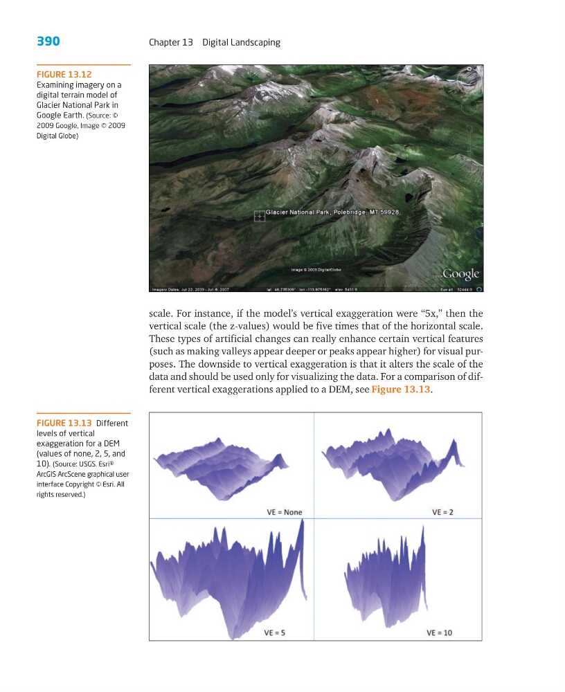
data and should be used only for visualizing the data. For a comparison of different vertical exaggerations applied to a DEM, see Figure 13.13.
FIGURE 13.12
Examining imagery on a
digital terrain model of
Glacier National Park in
Google Earth. (Source: ©
2009 Google, Image © 2009
Digital Globe)
FIGURE 13.13 Different
levels of vertical
exaggeration for a DEM
(values of none, 2, 5, and
10). (Source: USGS. Esri®
ArcGIS ArcScene graphical user
interface Copyright © Esri. All
rights reserved.)
Chapter 13 Digital Landscaping
scale. For instance, if the model’s vertical exaggeration were “5x,” then the
vertical scale (the z-values) would be five times that of the horizontal scale.
These types of artificial changes can really enhance certain vertical features
(such as making valleys appear deeper or peaks appear higher) for visual purposes. The downside to vertical exaggeration is that it alters the scale of the
data and should be used only for visualizing the data. For a comparison of different vertical exaggerations applied to a DEM, see Figure 13.13.
FIGURE 13.12
Examining imagery on a
digital terrain model of
Glacier National Park in
Google Earth. (Source: ©
2009 Google, Image © 2009
Digital Globe)
FIGURE 13.13 Different
levels of vertical
exaggeration for a DEM
(values of none, 2, 5, and
10). (Source: USGS. Esri®
ArcGIS ArcScene graphical user
interface Copyright © Esri. All
rights reserved.)