

21
Introduction to Geospatial Concepts and Google Earth
2. To see the boundaries of Badlands National Park in Google Earth, go to
the Layers Box and expand the option for More (click on the plus button
to the left of the name). In the options that appear under the expanded
heading, put a checkmark in the Parks/Recreation Areas option.
Zoom out from the boundaries of Wall and (to the south) you’ll see the
northernmost boundary of Badlands National Park highlighted in green.
3. Zoom out so that you can see the entire park in the view. New icons for
the locations of Visitors Centers and other features will also appear.
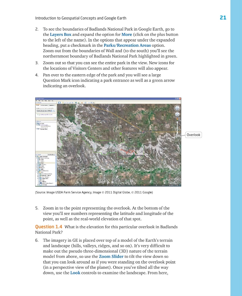
4. Pan over to the eastern edge of the park and you will see a large
Question Mark icon indicating a park entrance as well as a green arrow
indicating an overlook.
5. Zoom in to the point representing the overlook. At the bottom of the
view you’ll see numbers representing the latitude and longitude of the
point, as well as the real-world elevation of that spot.
Question 1.4 What is the elevation for this particular overlook in Badlands
National Park?
6. The imagery in GE is placed over top of a model of the Earth’s terrain
and landscape (hills, valleys, ridges, and so on). It’s very difficult to
make out the pseudo three-dimensional (3D) nature of the terrain
model from above, so use the Zoom Slider to tilt the view down so
that you can look around as if you were standing on the overlook point
(in a perspective view of the planet). Once you’ve tilted all the way
down, use the Look controls to examine the landscape. From here,
(Source: Image USDA Farm Service Agency, Image © 2011 Digital Globe, © 2011 Google)
Overlook
Introduction to Geospatial Concepts and Google Earth
2. To see the boundaries of Badlands National Park in Google Earth, go to
the Layers Box and expand the option for More (click on the plus button
to the left of the name). In the options that appear under the expanded
heading, put a checkmark in the Parks/Recreation Areas option.
Zoom out from the boundaries of Wall and (to the south) you’ll see the
northernmost boundary of Badlands National Park highlighted in green.
3. Zoom out so that you can see the entire park in the view. New icons for
the locations of Visitors Centers and other features will also appear.
4. Pan over to the eastern edge of the park and you will see a large
Question Mark icon indicating a park entrance as well as a green arrow
indicating an overlook.
5. Zoom in to the point representing the overlook. At the bottom of the
view you’ll see numbers representing the latitude and longitude of the
point, as well as the real-world elevation of that spot.
Question 1.4 What is the elevation for this particular overlook in Badlands
National Park?
6. The imagery in GE is placed over top of a model of the Earth’s terrain
and landscape (hills, valleys, ridges, and so on). It’s very difficult to
make out the pseudo three-dimensional (3D) nature of the terrain
model from above, so use the Zoom Slider to tilt the view down so
that you can look around as if you were standing on the overlook point
(in a perspective view of the planet). Once you’ve tilted all the way
down, use the Look controls to examine the landscape. From here,
(Source: Image USDA Farm Service Agency, Image © 2011 Digital Globe, © 2011 Google)
Overlook