

385
What Is a DEM?
geospatial data (see Chapter 15 for more about the National Map itself). With
the National Map Seamless Server, you can specify the geographic region you
require data for and select from multiple datasets that cover that region to
download. NED data is available at 1 arc second (about 30-meter), 1/3 arc
second (about 10-meter), and 1/9 arc second (about 3-meter) resolutions,
depending on the region. In addition, digital topo maps and high-resolution
orthoimagery are among the many other datasets available for download (see
Hands-on Application 13.4: The National Map Seamless Server on page 386 for
more information on using the Seamless Server).
With terrain data, many different types of terrain analysis can be performed. DEMs are used in geospatial technology for creating viewsheds—
maps that show what can be seen or not seen from a particular vantage point.
A viewshed is used for determining how far a person’s visibility is (that is,
what they can see) from a location before his or her view is blocked by the
terrain. DEMs are also used for a variety of hydrologic applications, such as
calculating the accumulation of water in an area or extraction of stream channels or watersheds.
DEMs can be used to derive a new dataset of slope information— rather
than elevation values, slope represents the change of elevations (and the
rate of change) at a location by calculating the rise (vertical distance) over
the run (horizontal distance). When a slope surface is created from a DEM,
information can be derived not just about heights, but about the steepness
or flatness of areas. Similarly, a surface of slope aspect can be computed,
which will show (for each location) the direction that the slope is facing.
viewshed a data layer
that determines what
an observer can see
and cannot see from a
particular location due
to terrain.
slope a measurement
of the rate of elevation
change at a location,
found by dividing the
vertical height (the
rise) by the horizontal
length (the run).
slope aspect a
determination of the
direction that a slope is
facing.
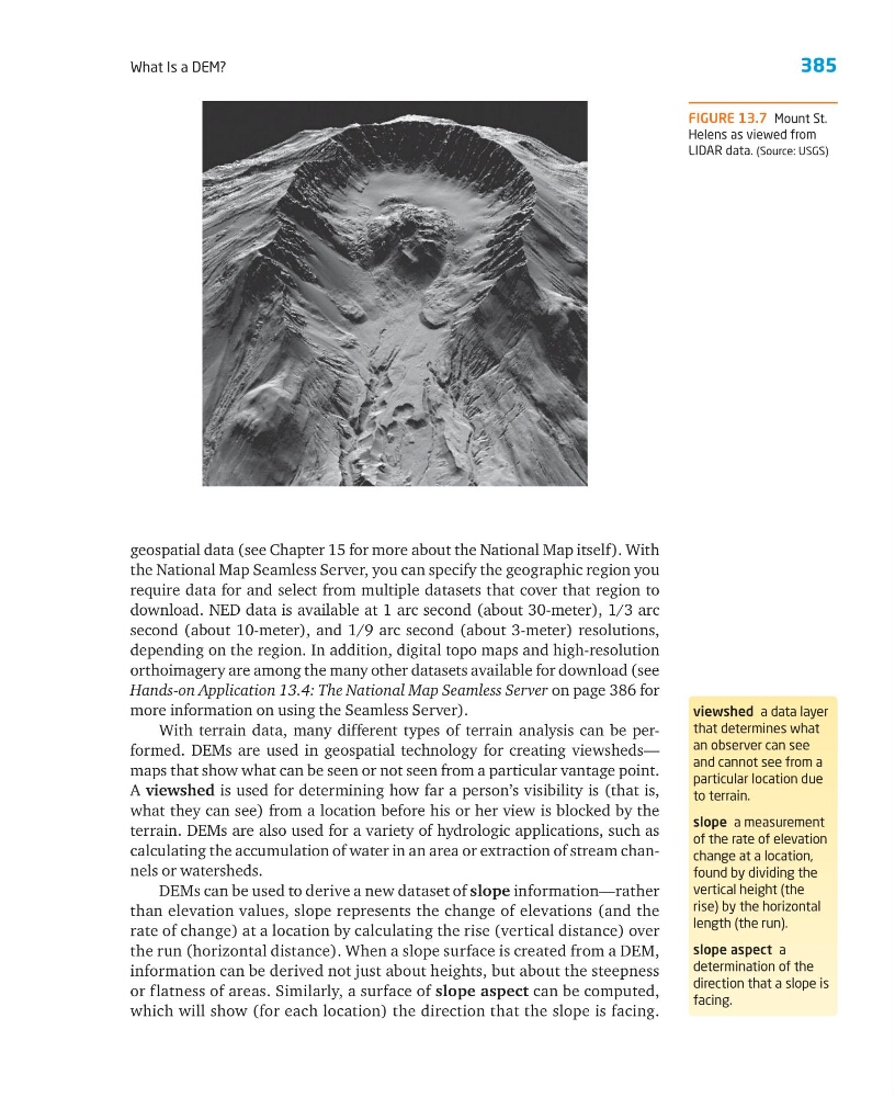
FIGURE 13.7 Mount St.
Helens as viewed from
LIDAR data. (Source: USGS)
What Is a DEM?
geospatial data (see Chapter 15 for more about the National Map itself). With
the National Map Seamless Server, you can specify the geographic region you
require data for and select from multiple datasets that cover that region to
download. NED data is available at 1 arc second (about 30-meter), 1/3 arc
second (about 10-meter), and 1/9 arc second (about 3-meter) resolutions,
depending on the region. In addition, digital topo maps and high-resolution
orthoimagery are among the many other datasets available for download (see
Hands-on Application 13.4: The National Map Seamless Server on page 386 for
more information on using the Seamless Server).
With terrain data, many different types of terrain analysis can be performed. DEMs are used in geospatial technology for creating viewsheds—
maps that show what can be seen or not seen from a particular vantage point.
A viewshed is used for determining how far a person’s visibility is (that is,
what they can see) from a location before his or her view is blocked by the
terrain. DEMs are also used for a variety of hydrologic applications, such as
calculating the accumulation of water in an area or extraction of stream channels or watersheds.
DEMs can be used to derive a new dataset of slope information— rather
than elevation values, slope represents the change of elevations (and the
rate of change) at a location by calculating the rise (vertical distance) over
the run (horizontal distance). When a slope surface is created from a DEM,
information can be derived not just about heights, but about the steepness
or flatness of areas. Similarly, a surface of slope aspect can be computed,
which will show (for each location) the direction that the slope is facing.
viewshed a data layer
that determines what
an observer can see
and cannot see from a
particular location due
to terrain.
slope a measurement
of the rate of elevation
change at a location,
found by dividing the
vertical height (the
rise) by the horizontal
length (the run).
slope aspect a
determination of the
direction that a slope is
facing.
FIGURE 13.7 Mount St.
Helens as viewed from
LIDAR data. (Source: USGS)