

378
Chapter 13 Digital Landscaping
How Can Terrain Be Represented?
A common (and widely available) method of representing terrain features is
the topographic map. As its name implies, a topographic map is designed
to show the topography of the land and the features on it. Topographic maps
(commonly called topo maps, for short) are published by the USGS (United
States Geological Survey) and are available at a variety of map scales. A common topographic map is a 1:24000 topoquad, also referred to as a 7.5 minute
topo map (as it displays an area covering 7.5 minutes of latitude by 7.5 minutes of longitude in size). Topo maps are also available in smaller map scales,
such as 1:100000 or 1:2000000. Topo maps are available in a digital format
as a DRG (Digital Raster Graphic). DRGs are scanned versions of topo maps
that have been georeferenced (see Chapter 3), so they’ll match up with other
geospatial data sources.
Usually, DRGs are available in GeoTIFF file format (see Chapter 7 for
more information about TIFFs), which allows for high-resolution images
while also having a spatial reference. Thus, when a DRG is used as a layer in
geospatial technology, it contains information to allow it to match up with
other data layers. A topo map (and thus, a DRG) also contains a lot of data
(including the scale, the dates of map creation and revision, and similar information) in the white border that surrounds the map. This border is referred to as the map’s collar. A topo map will either come with all of this
information intact, or in some cases, the collar will be removed and you will
have only the map itself. See Figure 13.2 for an example of a DRG complete
with collar.
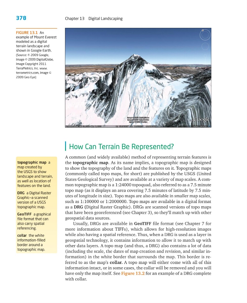
FIGURE 13.1 An
example of Mount Everest
modeled as a digital
terrain landscape and
shown in Google Earth.
(Source: © 2009 Google,
Image © 2009 DigitalGlobe,
Image Copyright 2011
TerraMetrics, Inc. www.
terrametrics.com, Image ©
2009 Geo Eye)
topographic map a
map created by
the USGS to show
landscape and terrain,
as well as location of
features on the land.
DRG a Digital Raster
Graphic—a scanned
version of a USGS
topographic map.
GeoTIFF a graphical
file format that can
also carry spatial
referencing.
collar the white
information-filled
border around a
topographic map.
Chapter 13 Digital Landscaping
How Can Terrain Be Represented?
A common (and widely available) method of representing terrain features is
the topographic map. As its name implies, a topographic map is designed
to show the topography of the land and the features on it. Topographic maps
(commonly called topo maps, for short) are published by the USGS (United
States Geological Survey) and are available at a variety of map scales. A common topographic map is a 1:24000 topoquad, also referred to as a 7.5 minute
topo map (as it displays an area covering 7.5 minutes of latitude by 7.5 minutes of longitude in size). Topo maps are also available in smaller map scales,
such as 1:100000 or 1:2000000. Topo maps are available in a digital format
as a DRG (Digital Raster Graphic). DRGs are scanned versions of topo maps
that have been georeferenced (see Chapter 3), so they’ll match up with other
geospatial data sources.
Usually, DRGs are available in GeoTIFF file format (see Chapter 7 for
more information about TIFFs), which allows for high-resolution images
while also having a spatial reference. Thus, when a DRG is used as a layer in
geospatial technology, it contains information to allow it to match up with
other data layers. A topo map (and thus, a DRG) also contains a lot of data
(including the scale, the dates of map creation and revision, and similar information) in the white border that surrounds the map. This border is referred to as the map’s collar. A topo map will either come with all of this
information intact, or in some cases, the collar will be removed and you will
have only the map itself. See Figure 13.2 for an example of a DRG complete
with collar.
FIGURE 13.1 An
example of Mount Everest
modeled as a digital
terrain landscape and
shown in Google Earth.
(Source: © 2009 Google,
Image © 2009 DigitalGlobe,
Image Copyright 2011
TerraMetrics, Inc. www.
terrametrics.com, Image ©
2009 Geo Eye)
topographic map a
map created by
the USGS to show
landscape and terrain,
as well as location of
features on the land.
DRG a Digital Raster
Graphic—a scanned
version of a USGS
topographic map.
GeoTIFF a graphical
file format that can
also carry spatial
referencing.
collar the white
information-filled
border around a
topographic map.