

376
Chapter 12 Studying the Environment from Space
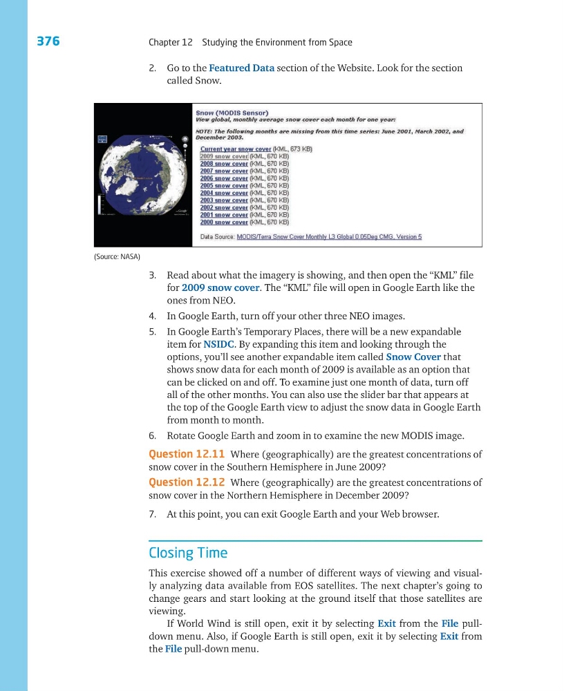
2. Go to the Featured Data section of the Website. Look for the section
called Snow.
3. Read about what the imagery is showing, and then open the “KML” file
for 2009 snow cover. The “KML” file will open in Google Earth like the
ones from NEO.
4. In Google Earth, turn off your other three NEO images.
5. In Google Earth’s Temporary Places, there will be a new expandable
item for NSIDC. By expanding this item and looking through the
options, you’ll see another expandable item called Snow Cover that
shows snow data for each month of 2009 is available as an option that
can be clicked on and off. To examine just one month of data, turn off
all of the other months. You can also use the slider bar that appears at
the top of the Google Earth view to adjust the snow data in Google Earth
from month to month.
6. Rotate Google Earth and zoom in to examine the new MODIS image.
Question 12.11 Where (geographically) are the greatest concentrations of
snow cover in the Southern Hemisphere in June 2009?
Question 12.12 Where (geographically) are the greatest concentrations of
snow cover in the Northern Hemisphere in December 2009?
7. At this point, you can exit Google Earth and your Web browser.
Closing Time
This exercise showed off a number of different ways of viewing and visually analyzing data available from EOS satellites. The next chapter’s going to
change gears and start looking at the ground itself that those satellites are
viewing.
If World Wind is still open, exit it by selecting Exit from the File pulldown menu. Also, if Google Earth is still open, exit it by selecting Exit from
the File pull-down menu.
(Source: NASA)
Chapter 12 Studying the Environment from Space
2. Go to the Featured Data section of the Website. Look for the section
called Snow.
3. Read about what the imagery is showing, and then open the “KML” file
for 2009 snow cover. The “KML” file will open in Google Earth like the
ones from NEO.
4. In Google Earth, turn off your other three NEO images.
5. In Google Earth’s Temporary Places, there will be a new expandable
item for NSIDC. By expanding this item and looking through the
options, you’ll see another expandable item called Snow Cover that
shows snow data for each month of 2009 is available as an option that
can be clicked on and off. To examine just one month of data, turn off
all of the other months. You can also use the slider bar that appears at
the top of the Google Earth view to adjust the snow data in Google Earth
from month to month.
6. Rotate Google Earth and zoom in to examine the new MODIS image.
Question 12.11 Where (geographically) are the greatest concentrations of
snow cover in the Southern Hemisphere in June 2009?
Question 12.12 Where (geographically) are the greatest concentrations of
snow cover in the Northern Hemisphere in December 2009?
7. At this point, you can exit Google Earth and your Web browser.
Closing Time
This exercise showed off a number of different ways of viewing and visually analyzing data available from EOS satellites. The next chapter’s going to
change gears and start looking at the ground itself that those satellites are
viewing.
If World Wind is still open, exit it by selecting Exit from the File pulldown menu. Also, if Google Earth is still open, exit it by selecting Exit from
the File pull-down menu.
(Source: NASA)