

372
Chapter 12 Studying the Environment from Space
10. Return to North America and examine some of the imagery associated
with the “Storm” icons—there are some good examples off the coast
of Florida (related to Tropical Storm Ernesto) and off the coast of New
England (for Tropical Storm Beryl).
Question 12.4 How are the scope and capabilities of the MODIS
instrument used for monitoring weather or storm formations such as these
Tropical Storms?
11. Close the MODIS Rapid Fire dialog box.
12.3 The Scientific Visualization Studio in
World Wind
The Scientific Visualization Studio is a tool in World Wind for using imagery
derived from some of the instruments aboard Aqua or Terra to examine Earth
phenomena over time through animations.
1. Click on the icon on the toolbar representing the Scientific Visualization
Studio (SVS).
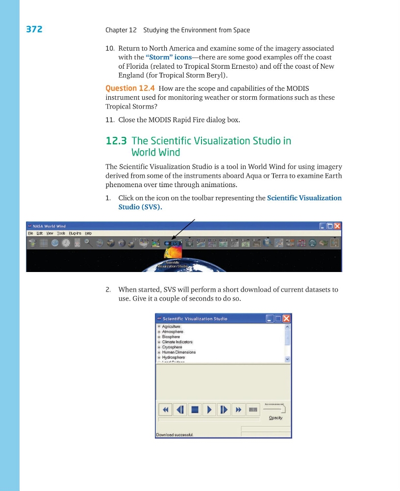
2. When started, SVS will perform a short download of current datasets to
use. Give it a couple of seconds to do so.
Chapter 12 Studying the Environment from Space
10. Return to North America and examine some of the imagery associated
with the “Storm” icons—there are some good examples off the coast
of Florida (related to Tropical Storm Ernesto) and off the coast of New
England (for Tropical Storm Beryl).
Question 12.4 How are the scope and capabilities of the MODIS
instrument used for monitoring weather or storm formations such as these
Tropical Storms?
11. Close the MODIS Rapid Fire dialog box.
12.3 The Scientific Visualization Studio in
World Wind
The Scientific Visualization Studio is a tool in World Wind for using imagery
derived from some of the instruments aboard Aqua or Terra to examine Earth
phenomena over time through animations.
1. Click on the icon on the toolbar representing the Scientific Visualization
Studio (SVS).
2. When started, SVS will perform a short download of current datasets to
use. Give it a couple of seconds to do so.