

16
Chapter 1 It’s a Geospatial World Out There
1.1 Starting to Use Google Earth
1. Start GE (the default install folder is called Google Earth). GE will
usually open with a startup tip box, which you can close. Also, make sure
the GE window is maximized, or else some features may not show up
properly.
A common use of GE is to view the ground (whether physical landscapes
or structures) from above by using the aerial photography or satellite
imagery streamed in from Google’s servers. The Fly To option in the
Search Box is used for this.
2. Select the Fly To tab and then type in “Mitchell, SD.” Next, click on
the Begin Search button (the magnifying glass next to where you
type).
3. GE will rotate and zoom the view down to eastern South Dakota. One
of the popular attractions in Mitchell is the Corn Palace, an event center
that, each year, remakes the façade of the building into a new theme
using corn. More information about the Corn Palace is available at
http://www.cornpalace.com/index.php.
4. In the Layers Box, place a checkmark in the Photos box. This enables
linking locations on the ground to photos that users have taken. The
locations that have linked photos appear as blue squares over top of the
imagery. You’ll see numerous photo locations clustered together in one
place—that would be the Corn Palace. Double-click on some of them to
see some photos (taken from the ground) of the Corn Palace.
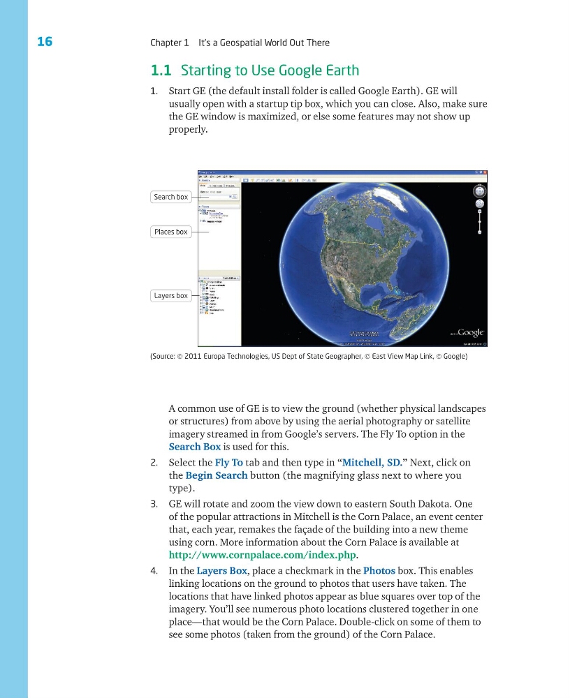
(Source: © 2011 Europa Technologies, US Dept of State Geographer, © East View Map Link, © Google)
Search box
Places box
Layers box
Chapter 1 It’s a Geospatial World Out There
1.1 Starting to Use Google Earth
1. Start GE (the default install folder is called Google Earth). GE will
usually open with a startup tip box, which you can close. Also, make sure
the GE window is maximized, or else some features may not show up
properly.
A common use of GE is to view the ground (whether physical landscapes
or structures) from above by using the aerial photography or satellite
imagery streamed in from Google’s servers. The Fly To option in the
Search Box is used for this.
2. Select the Fly To tab and then type in “Mitchell, SD.” Next, click on
the Begin Search button (the magnifying glass next to where you
type).
3. GE will rotate and zoom the view down to eastern South Dakota. One
of the popular attractions in Mitchell is the Corn Palace, an event center
that, each year, remakes the façade of the building into a new theme
using corn. More information about the Corn Palace is available at
http://www.cornpalace.com/index.php.
4. In the Layers Box, place a checkmark in the Photos box. This enables
linking locations on the ground to photos that users have taken. The
locations that have linked photos appear as blue squares over top of the
imagery. You’ll see numerous photo locations clustered together in one
place—that would be the Corn Palace. Double-click on some of them to
see some photos (taken from the ground) of the Corn Palace.
(Source: © 2011 Europa Technologies, US Dept of State Geographer, © East View Map Link, © Google)
Search box
Places box
Layers box