

277
What Are the Different Types of Aerial Photos?
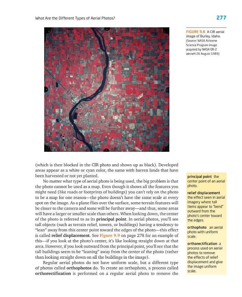
(which is then blocked in the CIR photo and shows up as black). Developed
areas appear as a white or cyan color, the same with barren lands that have
been harvested or not yet planted.
No matter what type of aerial photo is being used, the big problem is that
the photo cannot be used as a map. Even though it shows all the features you
might need (like roads or footprints of buildings) you can’t rely on the photo
to be a map for one reason—the photo doesn’t have the same scale at every
spot on the image. As a plane flies over the surface, some terrain features will
be closer to the camera and some will be further away—and thus, some areas
will have a larger or smaller scale than others. When looking down, the center
of the photo is referred to as its principal point. In aerial photos, you’ll see
tall objects (such as terrain relief, towers, or buildings) having a tendency to
“lean” away from this center point toward the edges of the photo—this effect
is called relief displacement. See Figure 9.9 on page 278 for an example of
this—if you look at the photo’s center, it’s like looking straight down at that
area. However, if you look outward from the principal point, you’ll see that the
tall buildings seem to be “leaning” away from the center of the photo (rather
than looking straight down on all the buildings in the image).
Regular aerial photos do not have uniform scale, but a different type
of photos called orthophotos do. To create an orthophoto, a process called
orthorectification is performed on a regular aerial photo to remove the
principal point the
center point of an aerial
photo.
relief displacement
the effect seen in aerial
imagery where tall
items appear to “bend”
outward from the
photo’s center toward
the edges.
orthophoto an aerial
photo with uniform
scale.
orthorectification a
process used on aerial
photos to remove
the effects of relief
displacement and give
the image uniform
scale.
FIGURE 9.8 A CIR aerial
image of Burley, Idaho.
(Source: NASA Airborne
Science Program image
acquired by NASA ER-2
aircraft 26 August 1983)
What Are the Different Types of Aerial Photos?
(which is then blocked in the CIR photo and shows up as black). Developed
areas appear as a white or cyan color, the same with barren lands that have
been harvested or not yet planted.
No matter what type of aerial photo is being used, the big problem is that
the photo cannot be used as a map. Even though it shows all the features you
might need (like roads or footprints of buildings) you can’t rely on the photo
to be a map for one reason—the photo doesn’t have the same scale at every
spot on the image. As a plane flies over the surface, some terrain features will
be closer to the camera and some will be further away—and thus, some areas
will have a larger or smaller scale than others. When looking down, the center
of the photo is referred to as its principal point. In aerial photos, you’ll see
tall objects (such as terrain relief, towers, or buildings) having a tendency to
“lean” away from this center point toward the edges of the photo—this effect
is called relief displacement. See Figure 9.9 on page 278 for an example of
this—if you look at the photo’s center, it’s like looking straight down at that
area. However, if you look outward from the principal point, you’ll see that the
tall buildings seem to be “leaning” away from the center of the photo (rather
than looking straight down on all the buildings in the image).
Regular aerial photos do not have uniform scale, but a different type
of photos called orthophotos do. To create an orthophoto, a process called
orthorectification is performed on a regular aerial photo to remove the
principal point the
center point of an aerial
photo.
relief displacement
the effect seen in aerial
imagery where tall
items appear to “bend”
outward from the
photo’s center toward
the edges.
orthophoto an aerial
photo with uniform
scale.
orthorectification a
process used on aerial
photos to remove
the effects of relief
displacement and give
the image uniform
scale.
FIGURE 9.8 A CIR aerial
image of Burley, Idaho.
(Source: NASA Airborne
Science Program image
acquired by NASA ER-2
aircraft 26 August 1983)