

264
Chapter 8 Getting There Quicker with Geospatial Technology
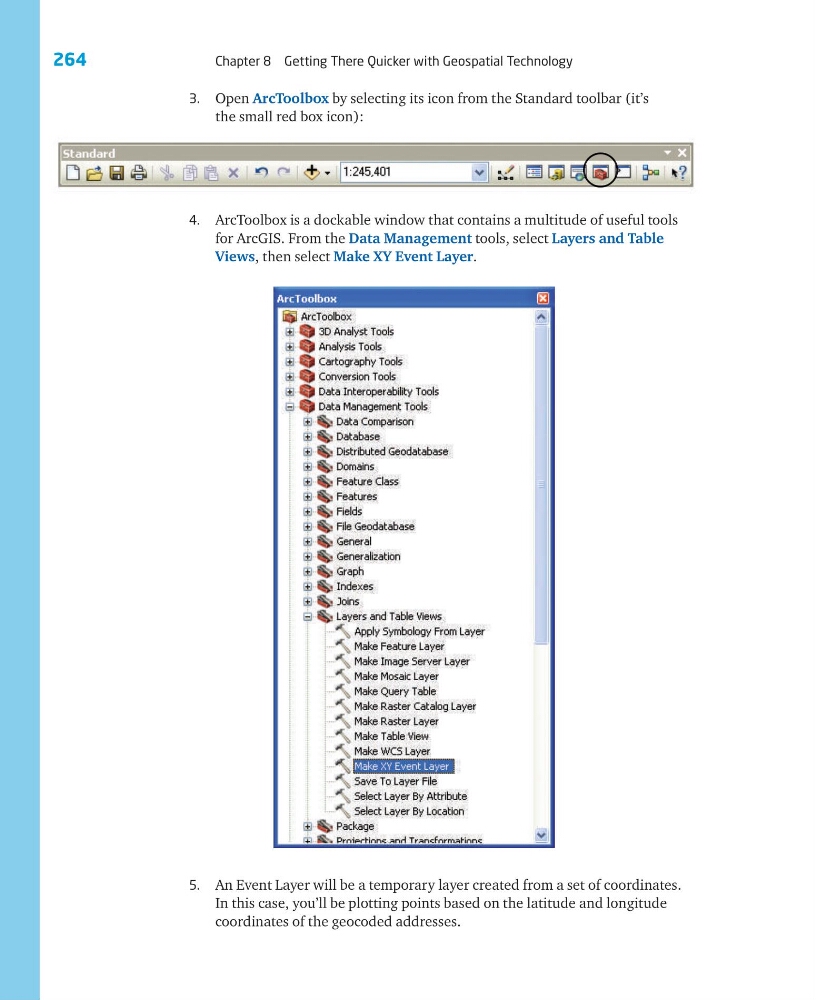
3. Open ArcToolbox by selecting its icon from the Standard toolbar (it’s
the small red box icon):
4. ArcToolbox is a dockable window that contains a multitude of useful tools
for ArcGIS. From the Data Management tools, select Layers and Table
Views, then select Make XY Event Layer.
5. An Event Layer will be a temporary layer created from a set of coordinates.
In this case, you’ll be plotting points based on the latitude and longitude
coordinates of the geocoded addresses.
Chapter 8 Getting There Quicker with Geospatial Technology
3. Open ArcToolbox by selecting its icon from the Standard toolbar (it’s
the small red box icon):
4. ArcToolbox is a dockable window that contains a multitude of useful tools
for ArcGIS. From the Data Management tools, select Layers and Table
Views, then select Make XY Event Layer.
5. An Event Layer will be a temporary layer created from a set of coordinates.
In this case, you’ll be plotting points based on the latitude and longitude
coordinates of the geocoded addresses.