

260
Chapter 8 Getting There Quicker with Geospatial Technology
8. All other fields can stay at their defaults.
9. In Step 3, click on the Make Google Map button.
10. You’ll see a Google Map generated of Virginia Beach that contains
symbols indicating the libraries’ locations. This indicates the geocoding
process is complete.
11. Pan and Zoom around the map to get a feel for where the libraries were
geocoded to. If you wanted, you could save this map for your own use.
However, at the time if this writing, you cannot access any coordinate
data for the points or download a Google Earth compatible file. In order
to get both of these things, you’ll use a different Web resource.
12. Open your Web browser and navigate to: http://www.gpsvisualizer.
com/geocoding.html.
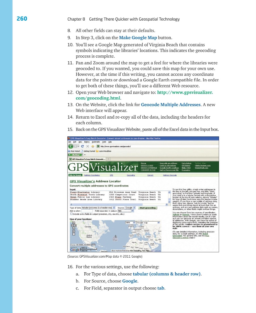
13. On the Website, click the link for Geocode Multiple Addresses. A new
Web interface will appear.
14. Return to Excel and re-copy all of the data, including the headers for
each column.
15. Back on the GPS Visualizer Website, paste all of the Excel data in the Input box.
(Source: GPSVisualizer.com/Map data © 2011 Google)
16. For the various settings, use the following:
a. For Type of data, choose tabular (columns & header row).
b. For Source, choose Google.
c. For Field, separator in output choose tab.
Chapter 8 Getting There Quicker with Geospatial Technology
8. All other fields can stay at their defaults.
9. In Step 3, click on the Make Google Map button.
10. You’ll see a Google Map generated of Virginia Beach that contains
symbols indicating the libraries’ locations. This indicates the geocoding
process is complete.
11. Pan and Zoom around the map to get a feel for where the libraries were
geocoded to. If you wanted, you could save this map for your own use.
However, at the time if this writing, you cannot access any coordinate
data for the points or download a Google Earth compatible file. In order
to get both of these things, you’ll use a different Web resource.
12. Open your Web browser and navigate to: http://www.gpsvisualizer.
com/geocoding.html.
13. On the Website, click the link for Geocode Multiple Addresses. A new
Web interface will appear.
14. Return to Excel and re-copy all of the data, including the headers for
each column.
15. Back on the GPS Visualizer Website, paste all of the Excel data in the Input box.
(Source: GPSVisualizer.com/Map data © 2011 Google)
16. For the various settings, use the following:
a. For Type of data, choose tabular (columns & header row).
b. For Source, choose Google.
c. For Field, separator in output choose tab.