

259
Geocoding and Shortest Path Analysis: ArcGIS Version
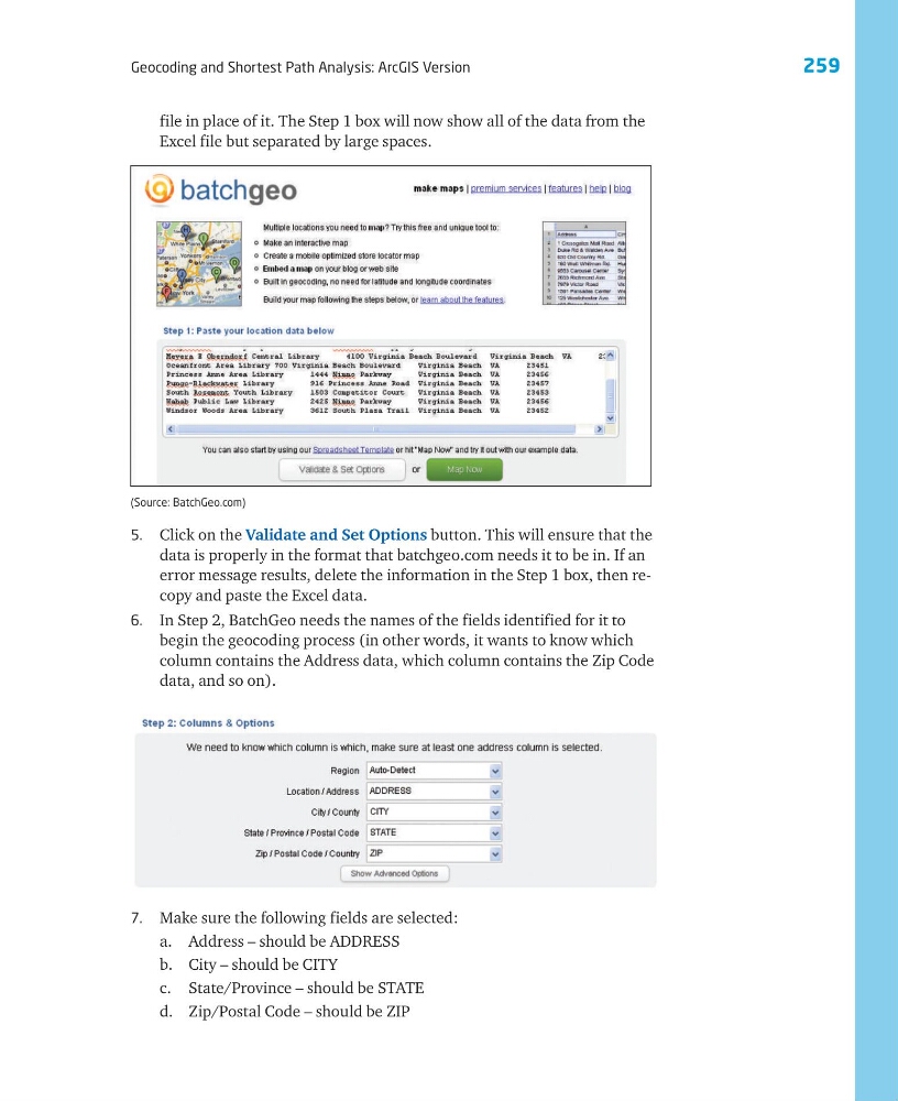
5. Click on the Validate and Set Options button. This will ensure that the
data is properly in the format that batchgeo.com needs it to be in. If an
error message results, delete the information in the Step 1 box, then recopy and paste the Excel data.
6. In Step 2, BatchGeo needs the names of the fields identified for it to
begin the geocoding process (in other words, it wants to know which
column contains the Address data, which column contains the Zip Code
data, and so on).
(Source: BatchGeo.com)
7. Make sure the following fields are selected:
a. Address – should be ADDRESS
b. City – should be CITY
c. State/Province – should be STATE
d. Zip/Postal Code – should be ZIP
file in place of it. The Step 1 box will now show all of the data from the
Excel file but separated by large spaces.
Geocoding and Shortest Path Analysis: ArcGIS Version
5. Click on the Validate and Set Options button. This will ensure that the
data is properly in the format that batchgeo.com needs it to be in. If an
error message results, delete the information in the Step 1 box, then recopy and paste the Excel data.
6. In Step 2, BatchGeo needs the names of the fields identified for it to
begin the geocoding process (in other words, it wants to know which
column contains the Address data, which column contains the Zip Code
data, and so on).
(Source: BatchGeo.com)
7. Make sure the following fields are selected:
a. Address – should be ADDRESS
b. City – should be CITY
c. State/Province – should be STATE
d. Zip/Postal Code – should be ZIP
file in place of it. The Step 1 box will now show all of the data from the
Excel file but separated by large spaces.