

252
Chapter 8 Getting There Quicker with Geospatial Technology
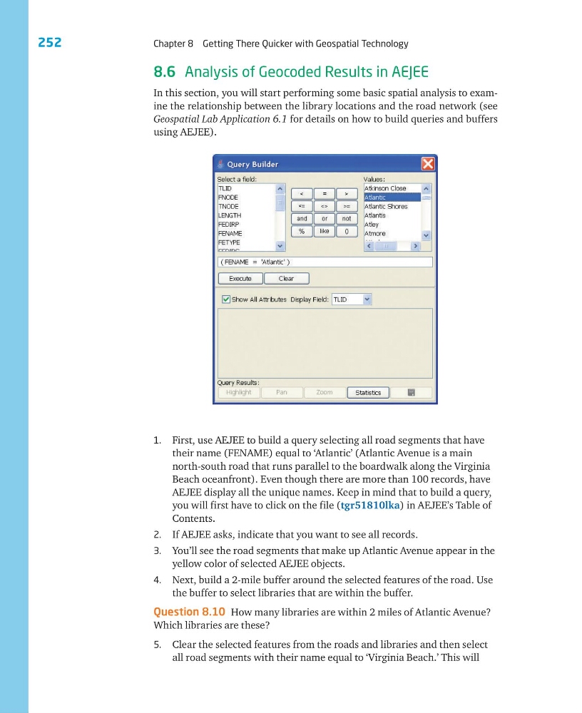
1. First, use AEJEE to build a query selecting all road segments that have
their name (FENAME) equal to ‘Atlantic’ (Atlantic Avenue is a main
north-south road that runs parallel to the boardwalk along the Virginia
Beach oceanfront). Even though there are more than 100 records, have
AEJEE display all the unique names. Keep in mind that to build a query,
you will first have to click on the file (tgr51810lka) in AEJEE’s Table of
Contents.
2. If AEJEE asks, indicate that you want to see all records.
3. You’ll see the road segments that make up Atlantic Avenue appear in the
yellow color of selected AEJEE objects.
4. Next, build a 2-mile buffer around the selected features of the road. Use
the buffer to select libraries that are within the buffer.
Question 8.10 How many libraries are within 2 miles of Atlantic Avenue?
Which libraries are these?
5. Clear the selected features from the roads and libraries and then select
all road segments with their name equal to ‘Virginia Beach.’ This will
8.6 Analysis of Geocoded Results in AEJEE
In this section, you will start performing some basic spatial analysis to examine the relationship between the library locations and the road network (see
Geospatial Lab Application 6.1 for details on how to build queries and buffers
using AEJEE).
Chapter 8 Getting There Quicker with Geospatial Technology
1. First, use AEJEE to build a query selecting all road segments that have
their name (FENAME) equal to ‘Atlantic’ (Atlantic Avenue is a main
north-south road that runs parallel to the boardwalk along the Virginia
Beach oceanfront). Even though there are more than 100 records, have
AEJEE display all the unique names. Keep in mind that to build a query,
you will first have to click on the file (tgr51810lka) in AEJEE’s Table of
Contents.
2. If AEJEE asks, indicate that you want to see all records.
3. You’ll see the road segments that make up Atlantic Avenue appear in the
yellow color of selected AEJEE objects.
4. Next, build a 2-mile buffer around the selected features of the road. Use
the buffer to select libraries that are within the buffer.
Question 8.10 How many libraries are within 2 miles of Atlantic Avenue?
Which libraries are these?
5. Clear the selected features from the roads and libraries and then select
all road segments with their name equal to ‘Virginia Beach.’ This will
8.6 Analysis of Geocoded Results in AEJEE
In this section, you will start performing some basic spatial analysis to examine the relationship between the library locations and the road network (see
Geospatial Lab Application 6.1 for details on how to build queries and buffers
using AEJEE).