

230
Chapter 8 Getting There Quicker with Geospatial Technology
Next, the address information is parsed into its component pieces, and
address standardization is performed to set up data in a consistent format.
The geocoding process needs to standardize addresses to properly match a
location using its appropriate attributes in the reference database. Table 8.1
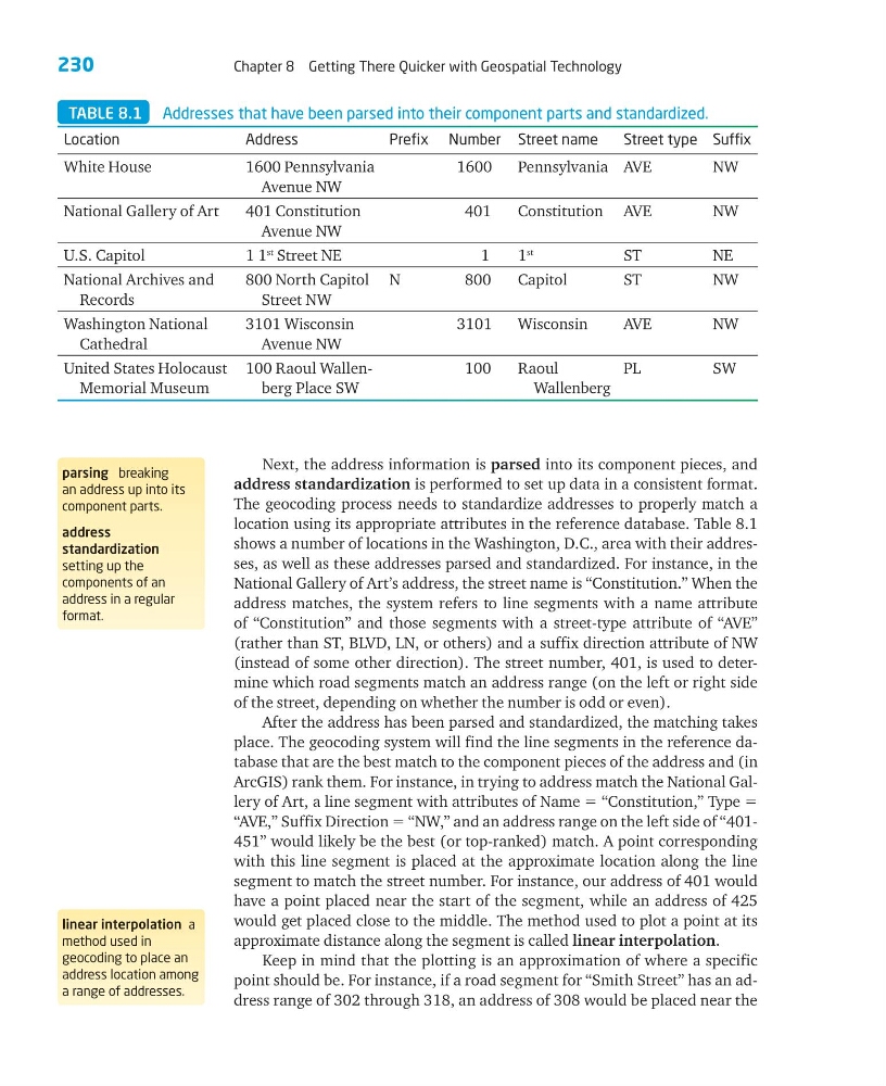
shows a number of locations in the Washington, D.C., area with their addresses, as well as these addresses parsed and standardized. For instance, in the
National Gallery of Art’s address, the street name is “Constitution.” When the
address matches, the system refers to line segments with a name attribute
of “Constitution” and those segments with a street-type attribute of “AVE”
(rather than ST, BLVD, LN, or others) and a suffix direction attribute of NW
(instead of some other direction). The street number, 401, is used to determine which road segments match an address range (on the left or right side
of the street, depending on whether the number is odd or even).
After the address has been parsed and standardized, the matching takes
place. The geocoding system will find the line segments in the reference database that are the best match to the component pieces of the address and (in
ArcGIS) rank them. For instance, in trying to address match the National Gallery of Art, a line segment with attributes of Name ϭ “Constitution,” Type ϭ
“AVE,” Suffix Direction ϭ “NW,” and an address range on the left side of “401451” would likely be the best (or top-ranked) match. A point corresponding
with this line segment is placed at the approximate location along the line
segment to match the street number. For instance, our address of 401 would
have a point placed near the start of the segment, while an address of 425
would get placed close to the middle. The method used to plot a point at its
approximate distance along the segment is called linear interpolation.
Keep in mind that the plotting is an approximation of where a specific
point should be. For instance, if a road segment for “Smith Street” has an address range of 302 through 318, an address of 308 would be placed near the
parsing breaking
an address up into its
component parts.
address
standardization
setting up the
components of an
address in a regular
format.
linear interpolation a
method used in
geocoding to place an
address location among
a range of addresses.
TABLE 8.1 Addresses that have been parsed into their component parts and standardized.
Location
Address
Prefix Number Street name
Street type Suffix
White House
1600 Pennsylvania
Avenue NW
1600
Pennsylvania AVE
NW
National Gallery of Art
401 Constitution
Avenue NW
401
Constitution AVE
NW
U.S. Capitol
1 1
st Street NE
1
1
st
ST
NE
National Archives and
Records
800 North Capitol
Street NW
N
800
Capitol
ST
NW
Washington National
Cathedral
3101 Wisconsin
Avenue NW
3101
Wisconsin
AVE
NW
United States Holocaust
Memorial Museum
100 Raoul Wallenberg Place SW
100
Raoul
Wallenberg
PL
SW
Chapter 8 Getting There Quicker with Geospatial Technology
Next, the address information is parsed into its component pieces, and
address standardization is performed to set up data in a consistent format.
The geocoding process needs to standardize addresses to properly match a
location using its appropriate attributes in the reference database. Table 8.1
shows a number of locations in the Washington, D.C., area with their addresses, as well as these addresses parsed and standardized. For instance, in the
National Gallery of Art’s address, the street name is “Constitution.” When the
address matches, the system refers to line segments with a name attribute
of “Constitution” and those segments with a street-type attribute of “AVE”
(rather than ST, BLVD, LN, or others) and a suffix direction attribute of NW
(instead of some other direction). The street number, 401, is used to determine which road segments match an address range (on the left or right side
of the street, depending on whether the number is odd or even).
After the address has been parsed and standardized, the matching takes
place. The geocoding system will find the line segments in the reference database that are the best match to the component pieces of the address and (in
ArcGIS) rank them. For instance, in trying to address match the National Gallery of Art, a line segment with attributes of Name ϭ “Constitution,” Type ϭ
“AVE,” Suffix Direction ϭ “NW,” and an address range on the left side of “401451” would likely be the best (or top-ranked) match. A point corresponding
with this line segment is placed at the approximate location along the line
segment to match the street number. For instance, our address of 401 would
have a point placed near the start of the segment, while an address of 425
would get placed close to the middle. The method used to plot a point at its
approximate distance along the segment is called linear interpolation.
Keep in mind that the plotting is an approximation of where a specific
point should be. For instance, if a road segment for “Smith Street” has an address range of 302 through 318, an address of 308 would be placed near the
parsing breaking
an address up into its
component parts.
address
standardization
setting up the
components of an
address in a regular
format.
linear interpolation a
method used in
geocoding to place an
address location among
a range of addresses.
TABLE 8.1 Addresses that have been parsed into their component parts and standardized.
Location
Address
Prefix Number Street name
Street type Suffix
White House
1600 Pennsylvania
Avenue NW
1600
Pennsylvania AVE
NW
National Gallery of Art
401 Constitution
Avenue NW
401
Constitution AVE
NW
U.S. Capitol
1 1
st Street NE
1
1
st
ST
NE
National Archives and
Records
800 North Capitol
Street NW
N
800
Capitol
ST
NW
Washington National
Cathedral
3101 Wisconsin
Avenue NW
3101
Wisconsin
AVE
NW
United States Holocaust
Memorial Museum
100 Raoul Wallenberg Place SW
100
Raoul
Wallenberg
PL
SW