

165
GIS Spatial Analysis: AEJEE Version
Dakota and the locations of some cities and roads in the area, and then switches to the Great Lakes region in Section 6.6. With the sample data covering
the state boundaries and city locations for the whole United States, it’s easy
enough to select your city (or ones nearby), as well as major roads or lakes
and perform the same measurements and analysis using those places more
local to you than ones in these areas.
6.1 Some Initial Pre-Analysis Steps
1. Start AEJEE.
2. From the USA folder, add the following shapefiles: states, cities, lakes,
rivers, and intrstat.
3. Change the color schemes and symbology of each layer to make them
distinctive from each other for when you’ll be doing analysis. (See
5.1 Geospatial Lab Application: GIS Introduction: AEJEE Version for
how to do this.)
4. Position the layers in the Table of Contents (TOC) so that all layers are
visible (that is, the states layer is at the bottom of the TOC and the other
layers are arranged on top of it).
5. When the layers are set how you’d like them, zoom in to South Dakota,
so the state (and the nearby data) fills up the screen.
6.2 Database Queries
A database query is a standard feature in AEJEE. We’ll start off with a simple
query (using only one expression).
1. To build a query in AEJEE, select the layer you want to query (in this
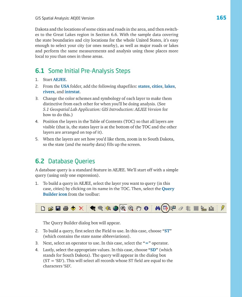
case, cities) by clicking on its name in the TOC. Then, select the Query
Builder icon from the toolbar:
The Query Builder dialog box will appear.
2. To build a query, first select the Field to use. In this case, choose “ST”
(which contains the state name abbreviations).
3. Next, select an operator to use. In this case, select the “=” operator.
4. Lastly, select the appropriate values. In this case, choose “SD” (which
stands for South Dakota). The query will appear in the dialog box
(ST = ‘SD’). This will select all records whose ST field are equal to the
characters ‘SD’.
GIS Spatial Analysis: AEJEE Version
Dakota and the locations of some cities and roads in the area, and then switches to the Great Lakes region in Section 6.6. With the sample data covering
the state boundaries and city locations for the whole United States, it’s easy
enough to select your city (or ones nearby), as well as major roads or lakes
and perform the same measurements and analysis using those places more
local to you than ones in these areas.
6.1 Some Initial Pre-Analysis Steps
1. Start AEJEE.
2. From the USA folder, add the following shapefiles: states, cities, lakes,
rivers, and intrstat.
3. Change the color schemes and symbology of each layer to make them
distinctive from each other for when you’ll be doing analysis. (See
5.1 Geospatial Lab Application: GIS Introduction: AEJEE Version for
how to do this.)
4. Position the layers in the Table of Contents (TOC) so that all layers are
visible (that is, the states layer is at the bottom of the TOC and the other
layers are arranged on top of it).
5. When the layers are set how you’d like them, zoom in to South Dakota,
so the state (and the nearby data) fills up the screen.
6.2 Database Queries
A database query is a standard feature in AEJEE. We’ll start off with a simple
query (using only one expression).
1. To build a query in AEJEE, select the layer you want to query (in this
case, cities) by clicking on its name in the TOC. Then, select the Query
Builder icon from the toolbar:
The Query Builder dialog box will appear.
2. To build a query, first select the Field to use. In this case, choose “ST”
(which contains the state name abbreviations).
3. Next, select an operator to use. In this case, select the “=” operator.
4. Lastly, select the appropriate values. In this case, choose “SD” (which
stands for South Dakota). The query will appear in the dialog box
(ST = ‘SD’). This will select all records whose ST field are equal to the
characters ‘SD’.