

152
Chapter 6 Using GIS for Spatial Analysis
GIS can also perform a dissolve operation, where boundaries between
adjacent polygons (that have the same properties) are removed, merging the
polygons into a single, larger shape. Dissolve is useful when you don’t need
to examine each polygon, only regions with similar properties. For example,
you have a land-use map of a county consisting of polygons representing each
individual parcel and how it’s being used (commercial, residential, agricultural, etc.). Rather than having to examine each individual parcel, you could
dissolve the boundaries between parcels, creating regions of “residential”
land use or “commercial” land use for ease of analysis. Similarly, if you have
overlapping buffers generated from features, dissolve can be used to combine
buffer zones together. See Figure 6.4 for an example of dissolve in action.
Buffers and querying are basic types of spatial analysis, but they only
involve a single layer of data (such as creating a buffer around roads or selecting all records that represent a highway). If you were going to do spatial
analysis along the lines of John Snow’s hunt for a cholera source, you’d have
to be able to do more than just select a subset of the population who died
or just selecting the locations of wells within the city borders—you’d have to
know something about how these two things interacted with each other over
a distance. For instance, you would want to know something about how many
cholera deaths were found within a certain distance of each well. Thus, you
wouldn’t just want to create a buffer around one layer (the wells), but you’d
want to know something about how many features from a different layer
(the death locations) were in that buffer. Many types of GIS analysis involve
combining the features from multiple layers together to allow examination
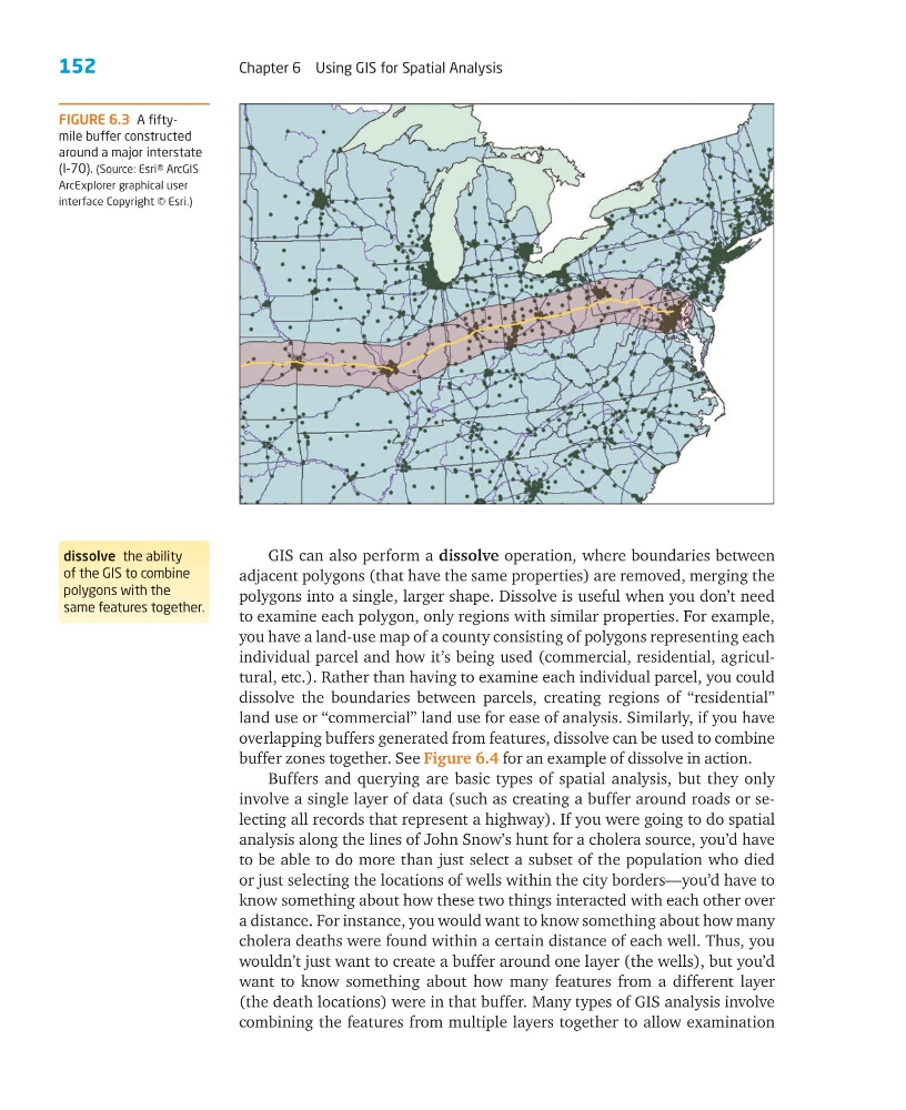
FIGURE 6.3 A fiftymile buffer constructed
around a major interstate
(I-70). (Source: Esri® ArcGIS
ArcExplorer graphical user
interface Copyright © Esri.)
dissolve the ability
of the GIS to combine
polygons with the
same features together.
Chapter 6 Using GIS for Spatial Analysis
GIS can also perform a dissolve operation, where boundaries between
adjacent polygons (that have the same properties) are removed, merging the
polygons into a single, larger shape. Dissolve is useful when you don’t need
to examine each polygon, only regions with similar properties. For example,
you have a land-use map of a county consisting of polygons representing each
individual parcel and how it’s being used (commercial, residential, agricultural, etc.). Rather than having to examine each individual parcel, you could
dissolve the boundaries between parcels, creating regions of “residential”
land use or “commercial” land use for ease of analysis. Similarly, if you have
overlapping buffers generated from features, dissolve can be used to combine
buffer zones together. See Figure 6.4 for an example of dissolve in action.
Buffers and querying are basic types of spatial analysis, but they only
involve a single layer of data (such as creating a buffer around roads or selecting all records that represent a highway). If you were going to do spatial
analysis along the lines of John Snow’s hunt for a cholera source, you’d have
to be able to do more than just select a subset of the population who died
or just selecting the locations of wells within the city borders—you’d have to
know something about how these two things interacted with each other over
a distance. For instance, you would want to know something about how many
cholera deaths were found within a certain distance of each well. Thus, you
wouldn’t just want to create a buffer around one layer (the wells), but you’d
want to know something about how many features from a different layer
(the death locations) were in that buffer. Many types of GIS analysis involve
combining the features from multiple layers together to allow examination
FIGURE 6.3 A fiftymile buffer constructed
around a major interstate
(I-70). (Source: Esri® ArcGIS
ArcExplorer graphical user
interface Copyright © Esri.)
dissolve the ability
of the GIS to combine
polygons with the
same features together.