

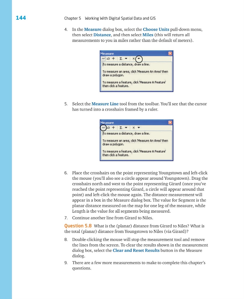
4. In the Measure dialog box, select the Choose Units pull-down menu,
then select Distance, and then select Miles (this will return all
measurements to you in miles rather than the default of meters).
5. Select the Measure Line tool from the toolbar. You’ll see that the cursor
has turned into a crosshairs framed by a ruler.
6. Place the crosshairs on the point representing Youngstown and left-click
the mouse (you’ll also see a circle appear around Youngstown). Drag the
crosshairs north and west to the point representing Girard (once you’ve
reached the point representing Girard, a circle will appear around that
point) and left-click the mouse again. The distance measurement will
appear in a box in the Measure dialog box. The value for Segment is the
planar distance measured on the map for one leg of the measure, while
Length is the value for all segments being measured.
7. Continue another line from Girard to Niles.
Question 5.8 What is the (planar) distance from Girard to Niles? What is
the total (planar) distance from Youngstown to Niles (via Girard)?
8. Double-clicking the mouse will stop the measurement tool and remove
the lines from the screen. To clear the results shown in the measurement
dialog box, select the Clear and Reset Results button in the Measure
dialog.
9. There are a few more measurements to make to complete this chapter’s
questions.
144
Chapter 5 Working With Digital Spatial Data and GIS
then select Distance, and then select Miles (this will return all
measurements to you in miles rather than the default of meters).
5. Select the Measure Line tool from the toolbar. You’ll see that the cursor
has turned into a crosshairs framed by a ruler.
6. Place the crosshairs on the point representing Youngstown and left-click
the mouse (you’ll also see a circle appear around Youngstown). Drag the
crosshairs north and west to the point representing Girard (once you’ve
reached the point representing Girard, a circle will appear around that
point) and left-click the mouse again. The distance measurement will
appear in a box in the Measure dialog box. The value for Segment is the
planar distance measured on the map for one leg of the measure, while
Length is the value for all segments being measured.
7. Continue another line from Girard to Niles.
Question 5.8 What is the (planar) distance from Girard to Niles? What is
the total (planar) distance from Youngstown to Niles (via Girard)?
8. Double-clicking the mouse will stop the measurement tool and remove
the lines from the screen. To clear the results shown in the measurement
dialog box, select the Clear and Reset Results button in the Measure
dialog.
9. There are a few more measurements to make to complete this chapter’s
questions.
144
Chapter 5 Working With Digital Spatial Data and GIS