

137
GIS Introduction: ArcGIS Version
Question 5.2 What units of measurement are being used in the interstates
dataset? What type of coordinate system (UTM, SPCS, etc.) is being used?
Question 5.3 What datum and projection are being used for the cities
dataset?
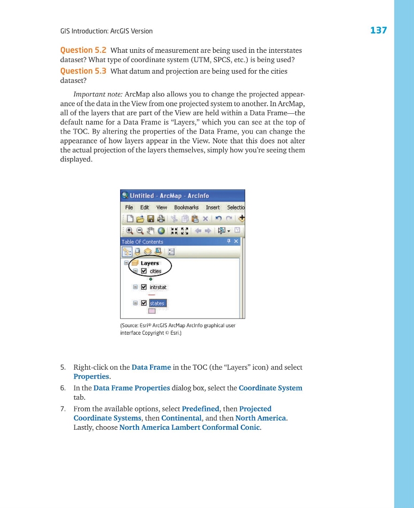
Important note: ArcMap also allows you to change the projected appearance of the data in the View from one projected system to another. In ArcMap,
all of the layers that are part of the View are held within a Data Frame—the
default name for a Data Frame is “Layers,” which you can see at the top of
the TOC. By altering the properties of the Data Frame, you can change the
appearance of how layers appear in the View. Note that this does not alter
the actual projection of the layers themselves, simply how you’re seeing them
displayed.
(Source: Esri® ArcGIS ArcMap ArcInfo graphical user
interface Copyright © Esri.)
5. Right-click on the Data Frame in the TOC (the “Layers” icon) and select
Properties.
6. In the Data Frame Properties dialog box, select the Coordinate System
tab.
7. From the available options, select Predefined, then Projected
Coordinate Systems, then Continental, and then North America.
Lastly, choose North America Lambert Conformal Conic.
GIS Introduction: ArcGIS Version
Question 5.2 What units of measurement are being used in the interstates
dataset? What type of coordinate system (UTM, SPCS, etc.) is being used?
Question 5.3 What datum and projection are being used for the cities
dataset?
Important note: ArcMap also allows you to change the projected appearance of the data in the View from one projected system to another. In ArcMap,
all of the layers that are part of the View are held within a Data Frame—the
default name for a Data Frame is “Layers,” which you can see at the top of
the TOC. By altering the properties of the Data Frame, you can change the
appearance of how layers appear in the View. Note that this does not alter
the actual projection of the layers themselves, simply how you’re seeing them
displayed.
(Source: Esri® ArcGIS ArcMap ArcInfo graphical user
interface Copyright © Esri.)
5. Right-click on the Data Frame in the TOC (the “Layers” icon) and select
Properties.
6. In the Data Frame Properties dialog box, select the Coordinate System
tab.
7. From the available options, select Predefined, then Projected
Coordinate Systems, then Continental, and then North America.
Lastly, choose North America Lambert Conformal Conic.