

116
Chapter 5 Working With Digital Spatial Data and GIS
ArcGIS Explorer has multiple functions for handling GIS data and other data
made available for use via the Internet (you’ll work with some of ArcGIS Explorer’s capabilities later in Chapter 15). See Hands-on Application 5.6: Esri
ArcNews, ArcUser, and ArcWatch for more information about Esri software
and applications.
With the proliferation of numerous Esri products on the market and in
use today, it’s no surprise that a lot of GIS data that is available is in an Esri
data format. Raster data is commonly available in (or can be easily imported
into) Esri Grid format, which can be directly read by Esri software. Vector
data can usually be found in one of the following three different varieties:
coverage, shapefile, and geodatabase.
Coverage is the original file format for Arc/Info. The coverage itself consists of multiple files inside of a directory structure. The folder that a coverage is stored in is referred to as a workspace and a workspace may contain
multiple coverages. A workspace will also contain a separate folder called the
INFO directory, which contains extra files needed by each coverage in the
workspace. Because of this structure of holding files, Esri created a method
to take all the necessary files that make up one coverage and export them to
a single file for portability. This exported file (which is called an “interchange
file” that ends with the file extension .e00) can then be moved to a different
location and reimported to rebuild the coverage structure on another folder
or computer.
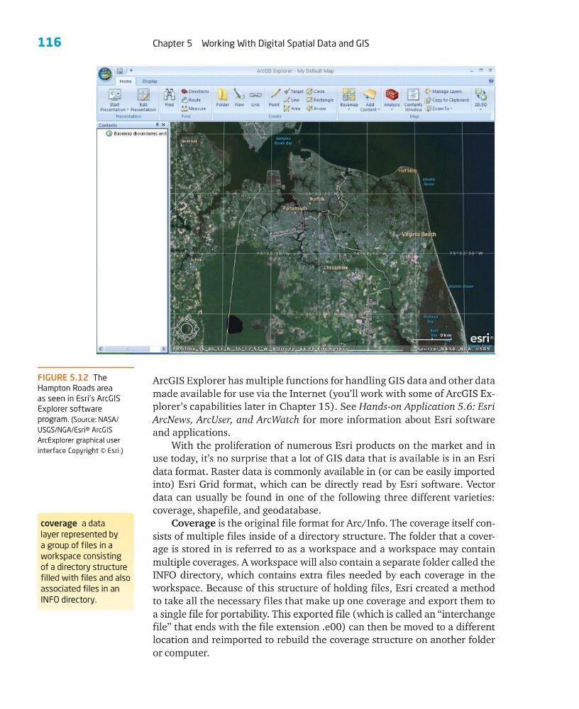
FIGURE 5.12 The
Hampton Roads area
as seen in Esri’s ArcGIS
Explorer software
program. (Source: NASA/
USGS/NGA/Esri® ArcGIS
ArcExplorer graphical user
interface Copyright © Esri.)
coverage a data
layer represented by
a group of files in a
workspace consisting
of a directory structure
filled with files and also
associated files in an
INFO directory.
Chapter 5 Working With Digital Spatial Data and GIS
ArcGIS Explorer has multiple functions for handling GIS data and other data
made available for use via the Internet (you’ll work with some of ArcGIS Explorer’s capabilities later in Chapter 15). See Hands-on Application 5.6: Esri
ArcNews, ArcUser, and ArcWatch for more information about Esri software
and applications.
With the proliferation of numerous Esri products on the market and in
use today, it’s no surprise that a lot of GIS data that is available is in an Esri
data format. Raster data is commonly available in (or can be easily imported
into) Esri Grid format, which can be directly read by Esri software. Vector
data can usually be found in one of the following three different varieties:
coverage, shapefile, and geodatabase.
Coverage is the original file format for Arc/Info. The coverage itself consists of multiple files inside of a directory structure. The folder that a coverage is stored in is referred to as a workspace and a workspace may contain
multiple coverages. A workspace will also contain a separate folder called the
INFO directory, which contains extra files needed by each coverage in the
workspace. Because of this structure of holding files, Esri created a method
to take all the necessary files that make up one coverage and export them to
a single file for portability. This exported file (which is called an “interchange
file” that ends with the file extension .e00) can then be moved to a different
location and reimported to rebuild the coverage structure on another folder
or computer.
FIGURE 5.12 The
Hampton Roads area
as seen in Esri’s ArcGIS
Explorer software
program. (Source: NASA/
USGS/NGA/Esri® ArcGIS
ArcExplorer graphical user
interface Copyright © Esri.)
coverage a data
layer represented by
a group of files in a
workspace consisting
of a directory structure
filled with files and also
associated files in an
INFO directory.