

2.4 FUSION OF MULTISCALE ELECTRO-OPTICAL DATA
2.4.1 Data Sets and Study Site
For our investigation, we selected a study area in Germany representing a part of the
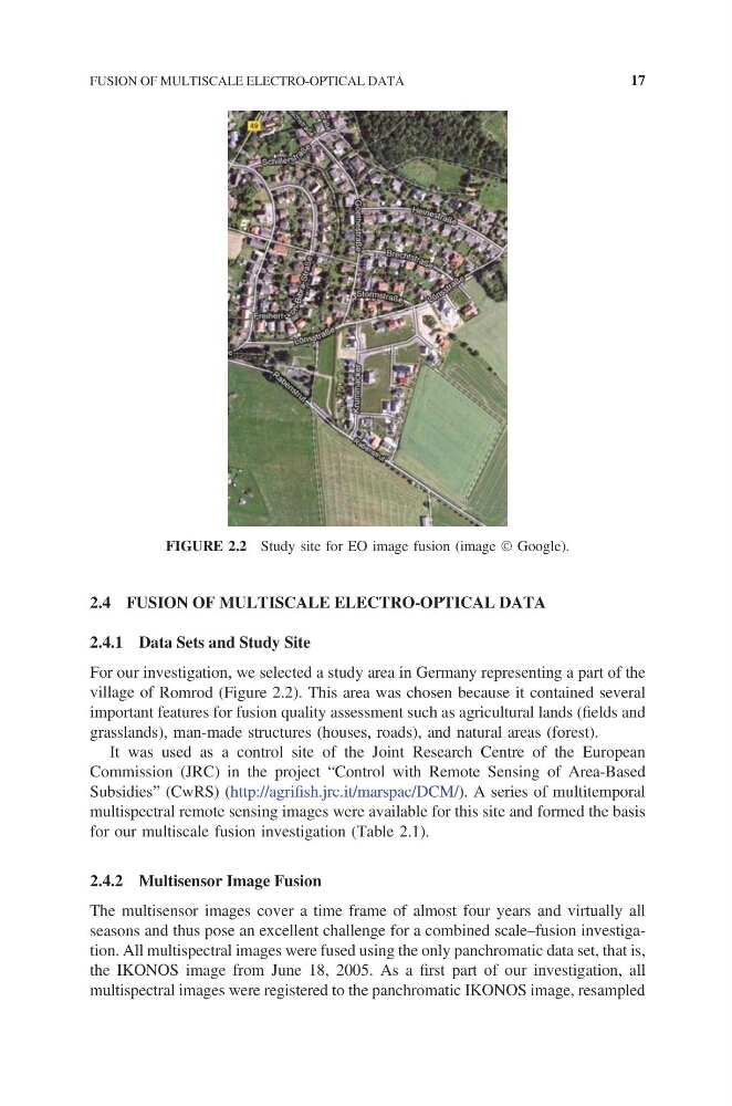
village of Romrod (Figure 2.2). This area was chosen because it contained several
important features for fusion quality assessment such as agricultural lands (fields and
grasslands), man-made structures (houses, roads), and natural areas (forest).
It was used as a control site of the Joint Research Centre of the European
Commission (JRC) in the project “Control with Remote Sensing of Area-Based
Subsidies ” (CwRS) (http://agr i fish.jrc.it /marspac/ DCM/). A seri es of mul titemporal
multispectral remote sensing images were available for this site and formed the basis
for our multiscale fusion investigation (Table 2.1).
2.4.2 Multisensor Image Fusion
The multisensor images cover a time frame of almost four years and virtually all
seasons and thus pose an excellent challenge for a combined scale–fusion investigation. All multispectral images were fused using the only panchromatic data set, that is,
the IKONOS image from June 18, 2005. As a first part of our investigation, all
multispectral images were registered to the panchromatic IKONOS image, resampled
FIGURE 2.2 Study site for EO image fusion (image Google).
FUSION OF MULTISCALE ELECTRO-OPTICAL DATA
17
2.4.1 Data Sets and Study Site
For our investigation, we selected a study area in Germany representing a part of the
village of Romrod (Figure 2.2). This area was chosen because it contained several
important features for fusion quality assessment such as agricultural lands (fields and
grasslands), man-made structures (houses, roads), and natural areas (forest).
It was used as a control site of the Joint Research Centre of the European
Commission (JRC) in the project “Control with Remote Sensing of Area-Based
Subsidies ” (CwRS) (http://agr i fish.jrc.it /marspac/ DCM/). A seri es of mul titemporal
multispectral remote sensing images were available for this site and formed the basis
for our multiscale fusion investigation (Table 2.1).
2.4.2 Multisensor Image Fusion
The multisensor images cover a time frame of almost four years and virtually all
seasons and thus pose an excellent challenge for a combined scale–fusion investigation. All multispectral images were fused using the only panchromatic data set, that is,
the IKONOS image from June 18, 2005. As a first part of our investigation, all
multispectral images were registered to the panchromatic IKONOS image, resampled
FIGURE 2.2 Study site for EO image fusion (image Google).
FUSION OF MULTISCALE ELECTRO-OPTICAL DATA
17