

14.6 DISCUSSION
Ground filtering is a processing step of the Lidar altimetry data that consists in
separating ground from nonground points. Since both terrain and off-ground
features happen at somewhat overlapping range of scales, separation of these
two components becomes tremendously difficult. Several studies have proven that
the size of a two-dimensional neighborhood is critical for ground filtering performance (Zhang et al., 2003; Zhang and Whitman, 2005). Others have shown that
the multiscale/multiresolution representations can be used for discriminating nonground points (Thuy and Tokunaga, 2004; Evans and Hudak, 2007). In general,
these methods tend to be less sensitive to parameter selection and are able to detect
features of various sizes.
This chapter presented a filtering method based on a multiscale signal decomposition termed the multiscale Hermite transform, which has been formulated in the
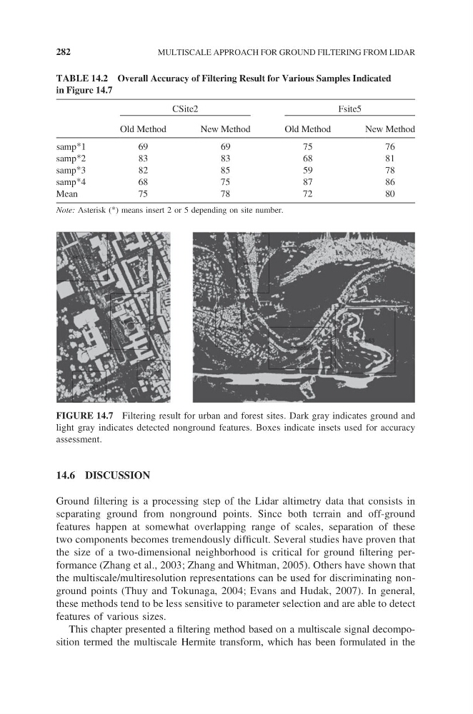
FIGURE 14.7 Filtering result for urban and forest sites. Dark gray indicates ground and
light gray indicates detected nonground features. Boxes indicate insets used for accuracy
assessment.
TABLE 14.2 Overall Accuracy of Filtering Result for Various Samples Indicated
in Figure 14.7
CSite2
Fsite5
Old Method
New Method
Old Method
New Method
samp*1
6 9
6 9
7 5
7 6
samp*2
8 3
8 3
6 8
8 1
samp*3
8 2
8 5
5 9
7 8
samp*4
6 8
7 5
8 7
8 6
Mean
75
78
72
80
Note: Asterisk (*) means insert 2 or 5 depending on site number.
282
MULTISCALE APPROACH FOR GROUND FILTERING FROM LIDAR
Ground filtering is a processing step of the Lidar altimetry data that consists in
separating ground from nonground points. Since both terrain and off-ground
features happen at somewhat overlapping range of scales, separation of these
two components becomes tremendously difficult. Several studies have proven that
the size of a two-dimensional neighborhood is critical for ground filtering performance (Zhang et al., 2003; Zhang and Whitman, 2005). Others have shown that
the multiscale/multiresolution representations can be used for discriminating nonground points (Thuy and Tokunaga, 2004; Evans and Hudak, 2007). In general,
these methods tend to be less sensitive to parameter selection and are able to detect
features of various sizes.
This chapter presented a filtering method based on a multiscale signal decomposition termed the multiscale Hermite transform, which has been formulated in the
FIGURE 14.7 Filtering result for urban and forest sites. Dark gray indicates ground and
light gray indicates detected nonground features. Boxes indicate insets used for accuracy
assessment.
TABLE 14.2 Overall Accuracy of Filtering Result for Various Samples Indicated
in Figure 14.7
CSite2
Fsite5
Old Method
New Method
Old Method
New Method
samp*1
6 9
6 9
7 5
7 6
samp*2
8 3
8 3
6 8
8 1
samp*3
8 2
8 5
5 9
7 8
samp*4
6 8
7 5
8 7
8 6
Mean
75
78
72
80
Note: Asterisk (*) means insert 2 or 5 depending on site number.
282
MULTISCALE APPROACH FOR GROUND FILTERING FROM LIDAR