

properties recorded in remotely sensed data acquired by various sensors, that is,
Landsat Multispectral Scanner (MSS), Landsat Thematic Mapper (TM)/Enhanced
Thematic Mapper Plus (ETM+), Advanced Spaceborne Thermal Emission and
Reflection (ASTER), and IKONOS; (2) to examine fractal properties of the urban
landscape derived by using raw and classified images; (3) to study the effect of scale
change on image properties with resampled images; and (4) to investigate the
potential of FD in revealing landscape changes between 1985 and 2000 by four
Landsat TM/ETM+ images.
12.2 STUDY AREA AND DATA SETS
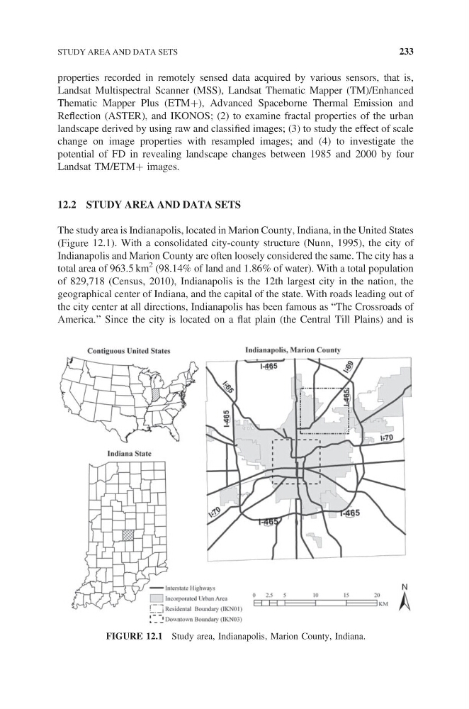
The study area is Indianapolis, located in Marion County, Indiana, in the United States
(Figure 12.1). With a consolidated city-county structure (Nunn, 1995), the city of
Indianapolis and Marion County are often loosely considered the same. The city has a
total area of 963.5 km
2 (98.14% of land and 1.86% of water). With a total population
of 829,718 (Census, 2010), Indianapolis is the 12th largest city in the nation, the
geographical center of Indiana, and the capital of the state. With roads leading out of
the city center at all directions, Indianapolis has been famous as “The Crossroads of
America.” Since the city is located on a flat plain (the Central Till Plains) and is
FIGURE 12.1 Study area, Indianapolis, Marion County, Indiana.
STUDY AREA AND DATA SETS
233
Landsat Multispectral Scanner (MSS), Landsat Thematic Mapper (TM)/Enhanced
Thematic Mapper Plus (ETM+), Advanced Spaceborne Thermal Emission and
Reflection (ASTER), and IKONOS; (2) to examine fractal properties of the urban
landscape derived by using raw and classified images; (3) to study the effect of scale
change on image properties with resampled images; and (4) to investigate the
potential of FD in revealing landscape changes between 1985 and 2000 by four
Landsat TM/ETM+ images.
12.2 STUDY AREA AND DATA SETS
The study area is Indianapolis, located in Marion County, Indiana, in the United States
(Figure 12.1). With a consolidated city-county structure (Nunn, 1995), the city of
Indianapolis and Marion County are often loosely considered the same. The city has a
total area of 963.5 km
2 (98.14% of land and 1.86% of water). With a total population
of 829,718 (Census, 2010), Indianapolis is the 12th largest city in the nation, the
geographical center of Indiana, and the capital of the state. With roads leading out of
the city center at all directions, Indianapolis has been famous as “The Crossroads of
America.” Since the city is located on a flat plain (the Central Till Plains) and is
FIGURE 12.1 Study area, Indianapolis, Marion County, Indiana.
STUDY AREA AND DATA SETS
233