

However, many of the riparian corridors were too narrow to be captured by
MODIS imagery, and a single MODIS pixel could not capture the variability of
defoliation within a site. Hence, imagery with different spatial and temporal scales
were needed to get a clear picture of defoliation effects.
5.3 LESSONS LEARNED FROM THESE
AND OTHER CHANGE STUDIES
5.3.1 Importance of Ground Measurement as Basis
for Remote Sensing Scaling Procedures
Although not the primary subject of this chapter, in our research we have found it
essential to build remote sensing methods on a foundation of ground measurements.
Often the goal of remote sensing studies is stated as developing “stand-alone” methods
that do not depend on ground data. However, in our research this has proven to be
impractical, leading to error and uncertainty in the remote sensing products. Furthermore, the ground methods used for calibration or validation of remote sensing algorithms
frequently contain rather large amounts of error or uncertainty, as discussed below.
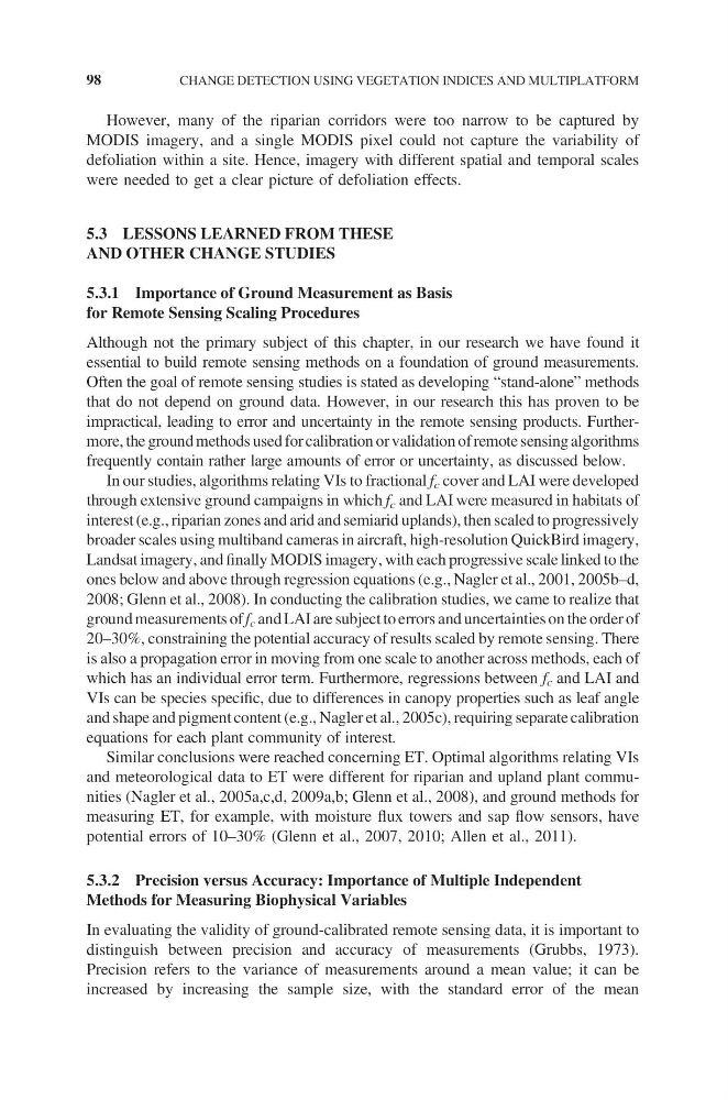
In our studies, algorithms relating VIs to fractional f c cover and LAI were developed
through extensive ground campaigns in which f c and LAI were measured in habitats of
interest (e.g., riparian zones and arid and semiarid uplands), then scaled to progressively
broader scales using multiband cameras in aircraft, high-resolution QuickBird imagery,
Landsat imagery, and finally MODIS imagery, with each progressive scale linked to the
ones below and above through regression equations (e.g., Nagler et al., 2001, 2005b–d,
2008; Glenn et al., 2008). In conducting the calibration studies, we came to realize that
ground measurements of f c and LAI are subject to errors and uncertainties on the order of
20–30%, constraining the potential accuracy of results scaled by remote sensing. There
is also a propagation error in moving from one scale to another across methods, each of
which has an individual error term. Furthermore, regressions between f c and LAI and
VIs can be species specific, due to differences in canopy properties such as leaf angle
and shape and pigment content (e.g., Nagler et al., 2005c), requiring separate calibration
equations for each plant community of interest.
Similar conclusions were reached concerning ET. Optimal algorithms relating VIs
and meteorological data to ET were different for riparian and upland plant communities (Nagler et al., 2005a,c,d, 2009a,b; Glenn et al., 2008), and ground methods for
measuring ET, for example, with moisture flux towers and sap flow sensors, have
potential errors of 10–30% (Glenn et al., 2007, 2010; Allen et al., 2011).
5.3.2 Precision versus Accuracy: Importance of Multiple Independent
Methods for Measuring Biophysical Variables
In evaluating the validity of ground-calibrated remote sensing data, it is important to
distinguish between precision and accuracy of measurements (Grubbs, 1973).
Precision refers to the variance of measurements around a mean value; it can be
increased by increasing the sample size, with the standard error of the mean
98
CHANGE DETECTION USING VEGETATION INDICES AND MULTIPLATFORM
MODIS imagery, and a single MODIS pixel could not capture the variability of
defoliation within a site. Hence, imagery with different spatial and temporal scales
were needed to get a clear picture of defoliation effects.
5.3 LESSONS LEARNED FROM THESE
AND OTHER CHANGE STUDIES
5.3.1 Importance of Ground Measurement as Basis
for Remote Sensing Scaling Procedures
Although not the primary subject of this chapter, in our research we have found it
essential to build remote sensing methods on a foundation of ground measurements.
Often the goal of remote sensing studies is stated as developing “stand-alone” methods
that do not depend on ground data. However, in our research this has proven to be
impractical, leading to error and uncertainty in the remote sensing products. Furthermore, the ground methods used for calibration or validation of remote sensing algorithms
frequently contain rather large amounts of error or uncertainty, as discussed below.
In our studies, algorithms relating VIs to fractional f c cover and LAI were developed
through extensive ground campaigns in which f c and LAI were measured in habitats of
interest (e.g., riparian zones and arid and semiarid uplands), then scaled to progressively
broader scales using multiband cameras in aircraft, high-resolution QuickBird imagery,
Landsat imagery, and finally MODIS imagery, with each progressive scale linked to the
ones below and above through regression equations (e.g., Nagler et al., 2001, 2005b–d,
2008; Glenn et al., 2008). In conducting the calibration studies, we came to realize that
ground measurements of f c and LAI are subject to errors and uncertainties on the order of
20–30%, constraining the potential accuracy of results scaled by remote sensing. There
is also a propagation error in moving from one scale to another across methods, each of
which has an individual error term. Furthermore, regressions between f c and LAI and
VIs can be species specific, due to differences in canopy properties such as leaf angle
and shape and pigment content (e.g., Nagler et al., 2005c), requiring separate calibration
equations for each plant community of interest.
Similar conclusions were reached concerning ET. Optimal algorithms relating VIs
and meteorological data to ET were different for riparian and upland plant communities (Nagler et al., 2005a,c,d, 2009a,b; Glenn et al., 2008), and ground methods for
measuring ET, for example, with moisture flux towers and sap flow sensors, have
potential errors of 10–30% (Glenn et al., 2007, 2010; Allen et al., 2011).
5.3.2 Precision versus Accuracy: Importance of Multiple Independent
Methods for Measuring Biophysical Variables
In evaluating the validity of ground-calibrated remote sensing data, it is important to
distinguish between precision and accuracy of measurements (Grubbs, 1973).
Precision refers to the variance of measurements around a mean value; it can be
increased by increasing the sample size, with the standard error of the mean
98
CHANGE DETECTION USING VEGETATION INDICES AND MULTIPLATFORM