

666
Climatic Geomorphology
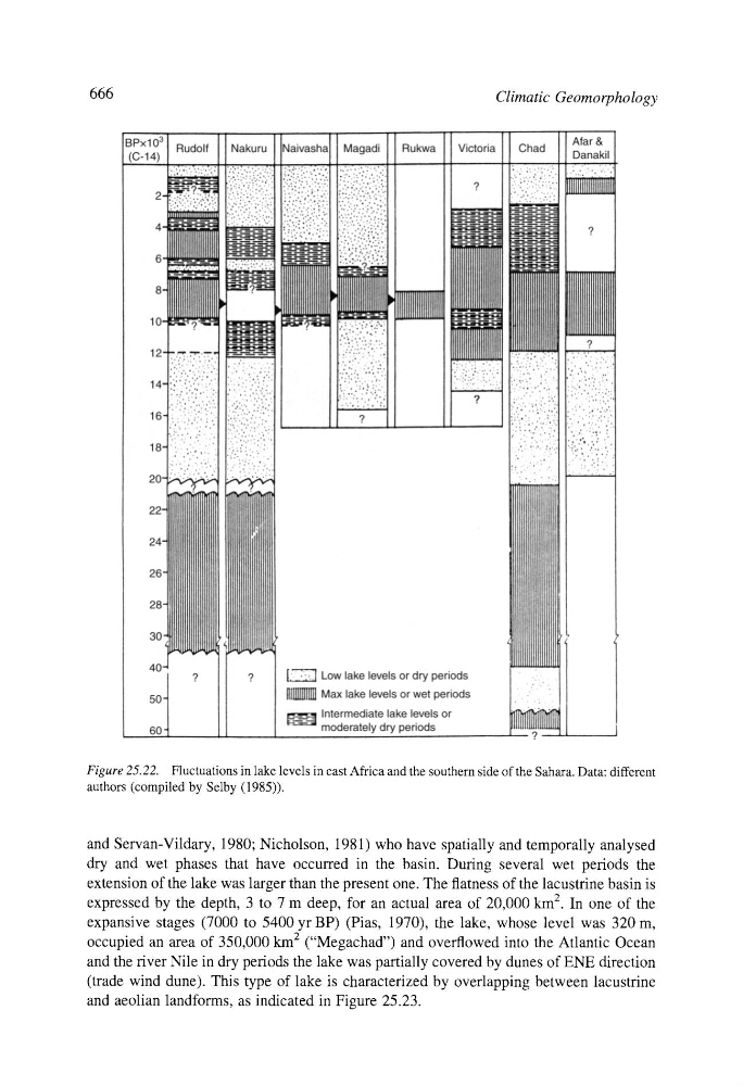
Figure 25.22. Fluctuations in lake levels in east Africa and the southern side of the Sahara. Data: different
authors (compiled by Selby (1985)).
and Servan-Vildary, 1980; Nicholson, 1981) who have spatially and temporally analysed
dry and wet phases that have occurred in the basin. During several wet periods the
extension of the lake was larger than the present one. The flatness of the lacustrine basin is
expressed by the depth, 3 to 7 m deep, for an actual area of 20,000 km 2. In one of the
expansive stages (7000 to 5400 yr BP) (Pias, 1970), the lake, whose level was 320 m,
occupied an area of 350,000 km 2 ("Megachad") and overflowed into the Atlantic Ocean
and the river Nile in dry periods the lake was partially covered by dunes of ENE direction
(trade wind dune). This type of lake is characterized by overlapping between lacustrine
and aeolian landforms, as indicated in Figure 25.23.