

126
Climatic Geomorphology
\
\
\ f
f
-10
~20
'-30
9
BOREHOLE
LOCATION
GEOLOGICAL
f
f
BOUNDARY
10 ROCKHEAD
J
CONTOUR
SAND ISOPACHYTES
N
T
0-10m
10 -20 rn
~
20m+
0
1
2
,_
J
J km
"40
-30
/
/
%
5o
!
[
\
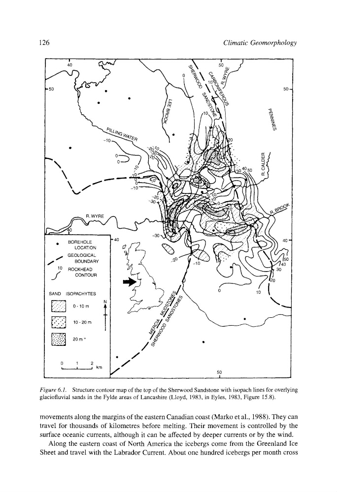
Figure 6.1. Structure contour map of the top of the Sherwood Sandstone with isopach lines for overlying
glaciofluvial sands in the Fylde areas of Lancashire (Lloyd, 1983, in Eyles, 1983, Figure 15.8).
movements along the margins of the eastern Canadian coast (Marko et al., 1988). They can
travel for thousands of kilometres before melting. Their movement is controlled by the
surface oceanic currents, although it can be affected by deeper currents or by the wind.
Along the eastern coast of North America the icebergs come from the Greenland Ice
Sheet and travel with the Labrador Current. About one hundred icebergs per month cross
Climatic Geomorphology
\
\
\ f
f
-10
~20
'-30
9
BOREHOLE
LOCATION
GEOLOGICAL
f
f
BOUNDARY
10 ROCKHEAD
J
CONTOUR
SAND ISOPACHYTES
N
T
0-10m
10 -20 rn
~
20m+
0
1
2
,_
J
J km
"40
-30
/
/
%
5o
!
[
\
Figure 6.1. Structure contour map of the top of the Sherwood Sandstone with isopach lines for overlying
glaciofluvial sands in the Fylde areas of Lancashire (Lloyd, 1983, in Eyles, 1983, Figure 15.8).
movements along the margins of the eastern Canadian coast (Marko et al., 1988). They can
travel for thousands of kilometres before melting. Their movement is controlled by the
surface oceanic currents, although it can be affected by deeper currents or by the wind.
Along the eastern coast of North America the icebergs come from the Greenland Ice
Sheet and travel with the Labrador Current. About one hundred icebergs per month cross