

Résumé
180
2.2. Geology, climate, and underwater morphology of the study area
The coastline of our study area is characterized by several topographic units, which are
represented by the Sahel of Algiers, the Mitidja plain, the coastal hills, and a mountainous
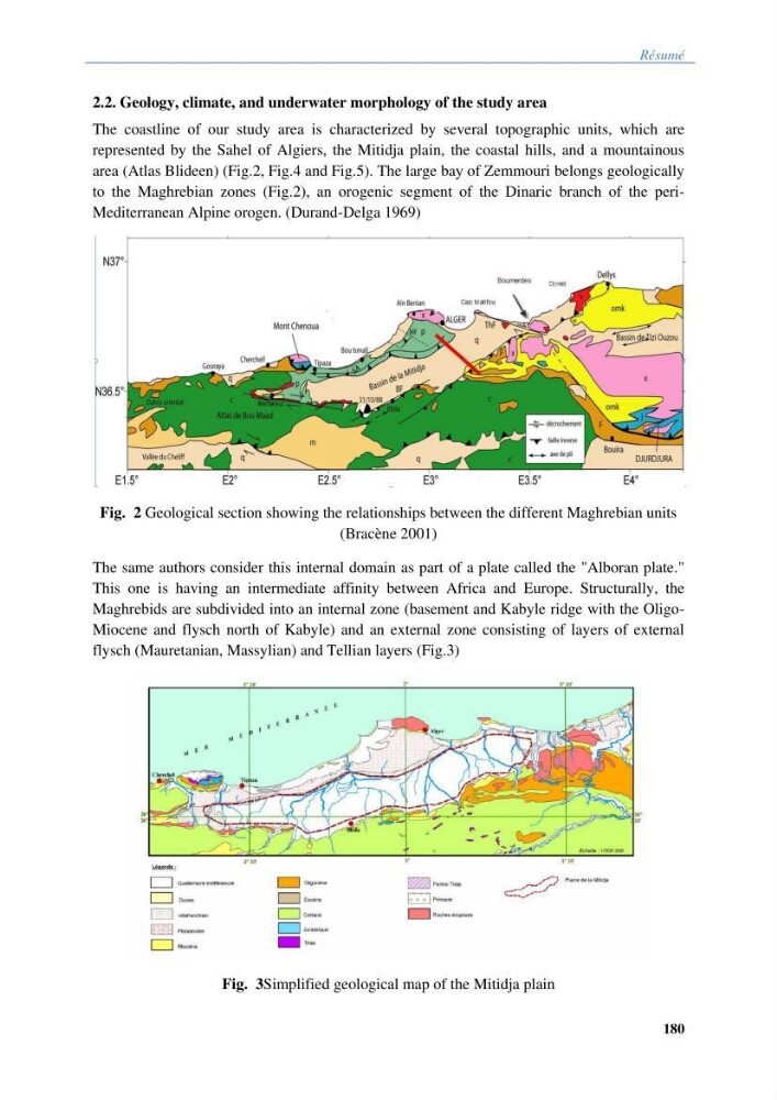
area (Atlas Blideen) (Fig.2, Fig.4 and Fig.5). The large bay of Zemmouri belongs geologically
to the Maghrebian zones (Fig.2), an orogenic segment of the Dinaric branch of the periMediterranean Alpine orogen. (Durand-Delga 1969)
Fig. 2 Geological section showing the relationships between the different Maghrebian units
(Bracène 2001)
The same authors consider this internal domain as part of a plate called the "Alboran plate."
This one is having an intermediate affinity between Africa and Europe. Structurally, the
Maghrebids are subdivided into an internal zone (basement and Kabyle ridge with the OligoMiocene and flysch north of Kabyle) and an external zone consisting of layers of external
flysch (Mauretanian, Massylian) and Tellian layers (Fig.3)
Fig. 3Simplified geological map of the Mitidja plain
180
2.2. Geology, climate, and underwater morphology of the study area
The coastline of our study area is characterized by several topographic units, which are
represented by the Sahel of Algiers, the Mitidja plain, the coastal hills, and a mountainous
area (Atlas Blideen) (Fig.2, Fig.4 and Fig.5). The large bay of Zemmouri belongs geologically
to the Maghrebian zones (Fig.2), an orogenic segment of the Dinaric branch of the periMediterranean Alpine orogen. (Durand-Delga 1969)
Fig. 2 Geological section showing the relationships between the different Maghrebian units
(Bracène 2001)
The same authors consider this internal domain as part of a plate called the "Alboran plate."
This one is having an intermediate affinity between Africa and Europe. Structurally, the
Maghrebids are subdivided into an internal zone (basement and Kabyle ridge with the OligoMiocene and flysch north of Kabyle) and an external zone consisting of layers of external
flysch (Mauretanian, Massylian) and Tellian layers (Fig.3)
Fig. 3Simplified geological map of the Mitidja plain