

250
E. Salameh et al.
18.2 Site 1: King Abdullah Canal (KAC)
The King Abdullah canal is a significant water project in
the country, as it is a main municipal and agricultural water
project for the Kingdom of Jordan. However, its water quality and quantity depend on the water supplied from outside sources in Israel and Syria. This canal extends from
the upper part of the Jordan Valley at Adasyeh down to the
Dead Sea with a total length of 110 km. The water originates
from the Yarmouk River, the international Jordan border
with Syria. The other sources are the Mukhaibeh Wells, the
peace-conveyer water, from Israel, and along the canal the
water from the side wadis and dams established on some of
the side wadis such as the Wadi Al Arab and Ziglab, (AlKhoury 2005; Hussein 2005; Ansari and Salameh 2006).
Presently, 60–70 MCM/year of water are pumped from
KAC to Amman with the provision for treatment at the Zai
plant, located between Deir Alla, the water intake site and
Amman (Jordan Valley Authority and Water Authority of
Jordan, Open file).
18.2.1 The KAC Study Area
The present study area extends along the KAC from its intake at the Yarmouk to Deir Alla, at an elevation of 235 m
below sea level to the south, along the left-hand side of the
Jordan River terraces with a length of 65 km. The coordinates of the canal are 32° 10′ 3.53″ N to 32° 39′ 48.70″ N and
35° 34′ 49.70″ E to 35° 36′ 13.72″ E in Universal Transverse
Mercator Grid (UTM) (Fig. 18.2).
The main objectives of this work were to study the parameters of the water which lead to algal activity, especially
blue-green algae, phyto- and zoo-plankton, bacteria, and the
eutrophication processes themselves. The parameters are:
PO
3−
4 , NO 3
− , light, temperature, and concentrations of trace
metals which are generally available in urbanized catchments.
Water samples were collected monthly, along the KAC
from the Yarmouk River at Nafq site to Deir Alla, from King
Talal Dam KTD) and from mixtures of KAC with KTD
water. Sampling site details are provided in Table 18.1 and
Fig. 18.2.
18.2.2 Results
18.2.2.1 Nutrients
The highest concentrations of phosphate ions (PO
3−
4 ) were
detected in the Yarmouk River while the lowest concentrations were found in the mixture of KAC and Ziglab Dam
water (Fig. 18.3). Deir Alla and the mixture of KAC and
Arab Dam waters have the highest concentrations of nitrate
ions. The lowest nitrate concentrations were found in the
• Muwaqqar Dams
• Rajil Dam
• Mujib Dam
} King Abdullah Canal
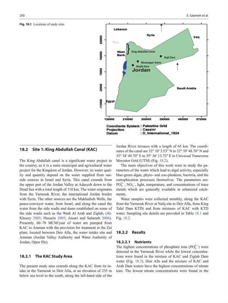
Fig. 18.1 Locations of study sites
E. Salameh et al.
18.2 Site 1: King Abdullah Canal (KAC)
The King Abdullah canal is a significant water project in
the country, as it is a main municipal and agricultural water
project for the Kingdom of Jordan. However, its water quality and quantity depend on the water supplied from outside sources in Israel and Syria. This canal extends from
the upper part of the Jordan Valley at Adasyeh down to the
Dead Sea with a total length of 110 km. The water originates
from the Yarmouk River, the international Jordan border
with Syria. The other sources are the Mukhaibeh Wells, the
peace-conveyer water, from Israel, and along the canal the
water from the side wadis and dams established on some of
the side wadis such as the Wadi Al Arab and Ziglab, (AlKhoury 2005; Hussein 2005; Ansari and Salameh 2006).
Presently, 60–70 MCM/year of water are pumped from
KAC to Amman with the provision for treatment at the Zai
plant, located between Deir Alla, the water intake site and
Amman (Jordan Valley Authority and Water Authority of
Jordan, Open file).
18.2.1 The KAC Study Area
The present study area extends along the KAC from its intake at the Yarmouk to Deir Alla, at an elevation of 235 m
below sea level to the south, along the left-hand side of the
Jordan River terraces with a length of 65 km. The coordinates of the canal are 32° 10′ 3.53″ N to 32° 39′ 48.70″ N and
35° 34′ 49.70″ E to 35° 36′ 13.72″ E in Universal Transverse
Mercator Grid (UTM) (Fig. 18.2).
The main objectives of this work were to study the parameters of the water which lead to algal activity, especially
blue-green algae, phyto- and zoo-plankton, bacteria, and the
eutrophication processes themselves. The parameters are:
PO
3−
4 , NO 3
− , light, temperature, and concentrations of trace
metals which are generally available in urbanized catchments.
Water samples were collected monthly, along the KAC
from the Yarmouk River at Nafq site to Deir Alla, from King
Talal Dam KTD) and from mixtures of KAC with KTD
water. Sampling site details are provided in Table 18.1 and
Fig. 18.2.
18.2.2 Results
18.2.2.1 Nutrients
The highest concentrations of phosphate ions (PO
3−
4 ) were
detected in the Yarmouk River while the lowest concentrations were found in the mixture of KAC and Ziglab Dam
water (Fig. 18.3). Deir Alla and the mixture of KAC and
Arab Dam waters have the highest concentrations of nitrate
ions. The lowest nitrate concentrations were found in the
• Muwaqqar Dams
• Rajil Dam
• Mujib Dam
} King Abdullah Canal
Fig. 18.1 Locations of study sites