

7. USING CURRENT AND FUTURE REMOTE SENSING SYSTEMS
IN NATURAL HAZARDS MANAGEMENT
57
amounts of data. Deliverables such as thematic maps, statistics, etc. should
be generated and distributed within hours of data acquisition by satellites.
In many cases, it may be critical to acquire data in all weather conditions.
This may impose particular technological constraints, such as the use of
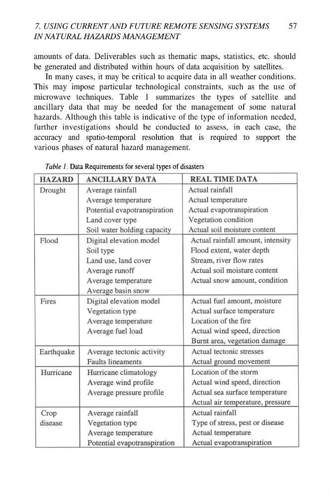
microwave techniques. Table 1 summarizes the types of satellite and
ancillary data that may be needed for the management of some natural
hazards. Although this table is indicative of the type of information needed,
further investigations should be conducted to assess, in each case, the
accuracy and spatio-temporal resolution that is required to support the
various phases of natural hazard management.
IN NATURAL HAZARDS MANAGEMENT
57
amounts of data. Deliverables such as thematic maps, statistics, etc. should
be generated and distributed within hours of data acquisition by satellites.
In many cases, it may be critical to acquire data in all weather conditions.
This may impose particular technological constraints, such as the use of
microwave techniques. Table 1 summarizes the types of satellite and
ancillary data that may be needed for the management of some natural
hazards. Although this table is indicative of the type of information needed,
further investigations should be conducted to assess, in each case, the
accuracy and spatio-temporal resolution that is required to support the
various phases of natural hazard management.