

and ‘‘uncertainties in surface reflectances’’ that allow to maintain consistency in
the retrieved LAI (Ganguly et al. 2008b). The analytical expressions for the total
BRF formulation (e.g. contributions from understory and canopy that are related to
reflectance, transmittance and absorptance simulations) are documented in (Ganguly et al. 2012) and are not provided here for the sake of brevity.
To achieve accurate retrievals from a particular sensor like Landsat, the simulated surface reflectances making up the LUT should be adjusted to be consistent
with the expected range of measured surface reflectances. The simulated surface
reflectances are highly sensitive to leaf single scattering albedo for medium-tohigh LAI and to soil reflectances for low LAI. The single scattering albedo is a
function of spatial resolution and accounts for the variation in BRF with sensor
spatial resolution and spectral bandwidth (c.f. Sects. 4 and 5 of Ganguly et al.
2008b). The theoretical scaling of the algorithm has been demonstrated by
(Ganguly et al. 2008a) to derive LAI from the AVHRR dataset that is consistent
with LAI products from other sensors such as MODIS and SPOT. In essence, the
BRF can be computed for the sensor-specific resolution and spectral bands by
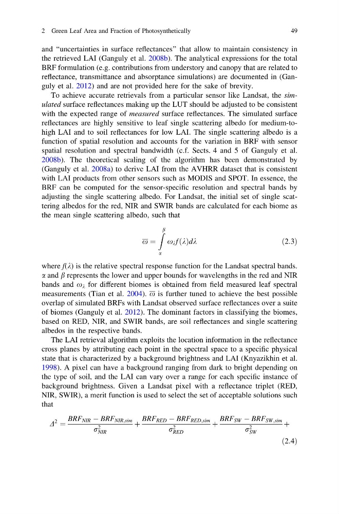
adjusting the single scattering albedo. For Landsat, the initial set of single scattering albedos for the red, NIR and SWIR bands are calculated for each biome as
the mean single scattering albedo, such that
x ¼
Z b
a
x k f k
ð Þdk
ð2:3Þ
where f(k) is the relative spectral response function for the Landsat spectral bands.
a and b represents the lower and upper bounds for wavelengths in the red and NIR
bands and x k for different biomes is obtained from field measured leaf spectral
measurements (Tian et al. 2004). x is further tuned to achieve the best possible
overlap of simulated BRFs with Landsat observed surface reflectances over a suite
of biomes (Ganguly et al. 2012). The dominant factors in classifying the biomes,
based on RED, NIR, and SWIR bands, are soil reflectances and single scattering
albedos in the respective bands.
The LAI retrieval algorithm exploits the location information in the reflectance
cross planes by attributing each point in the spectral space to a specific physical
state that is characterized by a background brightness and LAI (Knyazikhin et al.
1998). A pixel can have a background ranging from dark to bright depending on
the type of soil, and the LAI can vary over a range for each specific instance of
background brightness. Given a Landsat pixel with a reflectance triplet (RED,
NIR, SWIR), a merit function is used to select the set of acceptable solutions such
that
D
2 ¼
BRF NIR À BRF NIR;sim
r 2
NIR
þ
BRF RED À BRF RED;sim
r 2
RED
þ
BRF SW À BRF SW;sim
r 2
SW
þ
ð2:4Þ
2 Green Leaf Area and Fraction of Photosynthetically
49
the retrieved LAI (Ganguly et al. 2008b). The analytical expressions for the total
BRF formulation (e.g. contributions from understory and canopy that are related to
reflectance, transmittance and absorptance simulations) are documented in (Ganguly et al. 2012) and are not provided here for the sake of brevity.
To achieve accurate retrievals from a particular sensor like Landsat, the simulated surface reflectances making up the LUT should be adjusted to be consistent
with the expected range of measured surface reflectances. The simulated surface
reflectances are highly sensitive to leaf single scattering albedo for medium-tohigh LAI and to soil reflectances for low LAI. The single scattering albedo is a
function of spatial resolution and accounts for the variation in BRF with sensor
spatial resolution and spectral bandwidth (c.f. Sects. 4 and 5 of Ganguly et al.
2008b). The theoretical scaling of the algorithm has been demonstrated by
(Ganguly et al. 2008a) to derive LAI from the AVHRR dataset that is consistent
with LAI products from other sensors such as MODIS and SPOT. In essence, the
BRF can be computed for the sensor-specific resolution and spectral bands by
adjusting the single scattering albedo. For Landsat, the initial set of single scattering albedos for the red, NIR and SWIR bands are calculated for each biome as
the mean single scattering albedo, such that
x ¼
Z b
a
x k f k
ð Þdk
ð2:3Þ
where f(k) is the relative spectral response function for the Landsat spectral bands.
a and b represents the lower and upper bounds for wavelengths in the red and NIR
bands and x k for different biomes is obtained from field measured leaf spectral
measurements (Tian et al. 2004). x is further tuned to achieve the best possible
overlap of simulated BRFs with Landsat observed surface reflectances over a suite
of biomes (Ganguly et al. 2012). The dominant factors in classifying the biomes,
based on RED, NIR, and SWIR bands, are soil reflectances and single scattering
albedos in the respective bands.
The LAI retrieval algorithm exploits the location information in the reflectance
cross planes by attributing each point in the spectral space to a specific physical
state that is characterized by a background brightness and LAI (Knyazikhin et al.
1998). A pixel can have a background ranging from dark to bright depending on
the type of soil, and the LAI can vary over a range for each specific instance of
background brightness. Given a Landsat pixel with a reflectance triplet (RED,
NIR, SWIR), a merit function is used to select the set of acceptable solutions such
that
D
2 ¼
BRF NIR À BRF NIR;sim
r 2
NIR
þ
BRF RED À BRF RED;sim
r 2
RED
þ
BRF SW À BRF SW;sim
r 2
SW
þ
ð2:4Þ
2 Green Leaf Area and Fraction of Photosynthetically
49