

system based on fuzzy logic (Wang et al. 2004; Benfield et al. 2007). In this type
of analysis, the size, shape, and neighborhood context of a training block is taken
into account, as well as the spectral information, leading to increased classification
accuracy. This approach can be especially helpful when analyzing aerial photographs where spectral information is limited (relative to other multispectral or
hyperspectral imagery). In addition, because low-altitude aerial photographs have
relatively high spatial resolution, resulting in pixels being typically smaller than
the features they represent, they are well suited to OBIA. These advances suggest
that continued research in object-oriented analysis has promising potential as an
addition to the photographic toolbox for reef applications.
2.4 Example Applications of Photography
The case studies presented in this chapter were chosen to illustrate the broad range
of uses of aerial photography in coral reef management, but are by no means
inclusive of the many potential uses of this important data source. The first study
uses aerial photographs to create maps of coral reef environments in order to
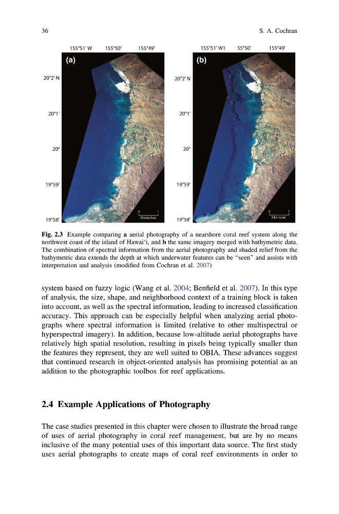
Fig. 2.3 Example comparing a aerial photography of a nearshore coral reef system along the
northwest coast of the island of Hawai‘i, and b the same imagery merged with bathymetric data.
The combination of spectral information from the aerial photography and shaded relief from the
bathymetric data extends the depth at which underwater features can be ‘‘seen’’ and assists with
interpretation and analysis (modified from Cochran et al. 2007)
36
S. A. Cochran
of analysis, the size, shape, and neighborhood context of a training block is taken
into account, as well as the spectral information, leading to increased classification
accuracy. This approach can be especially helpful when analyzing aerial photographs where spectral information is limited (relative to other multispectral or
hyperspectral imagery). In addition, because low-altitude aerial photographs have
relatively high spatial resolution, resulting in pixels being typically smaller than
the features they represent, they are well suited to OBIA. These advances suggest
that continued research in object-oriented analysis has promising potential as an
addition to the photographic toolbox for reef applications.
2.4 Example Applications of Photography
The case studies presented in this chapter were chosen to illustrate the broad range
of uses of aerial photography in coral reef management, but are by no means
inclusive of the many potential uses of this important data source. The first study
uses aerial photographs to create maps of coral reef environments in order to
Fig. 2.3 Example comparing a aerial photography of a nearshore coral reef system along the
northwest coast of the island of Hawai‘i, and b the same imagery merged with bathymetric data.
The combination of spectral information from the aerial photography and shaded relief from the
bathymetric data extends the depth at which underwater features can be ‘‘seen’’ and assists with
interpretation and analysis (modified from Cochran et al. 2007)
36
S. A. Cochran