

13.6 X-band Wave Radars
X-band (8–12 GHz) wave radars represent a niche technology in ocean remote
sensing. A normal nautical X-band rotating antenna is used to record the ‘clutter’
from ranges on the order of 1 km. The rotating antenna scans a scene every 3–4 s
and the images of the wave crests are displaced between scans. The two-dimensional pattern of echo strength can be transformed to produce the two-dimensional
sea surface elevation pattern, as illustrated in Fig. 13.16. X-band wave radars are
well suited for observing the wave field outside a reef structure and the changes
that occur as waves break on the reef front and the remnant energy appears
(sometimes at a different wave frequency) in the lagoon. The applications here are
for flushing dynamics and mixing at the reef front.
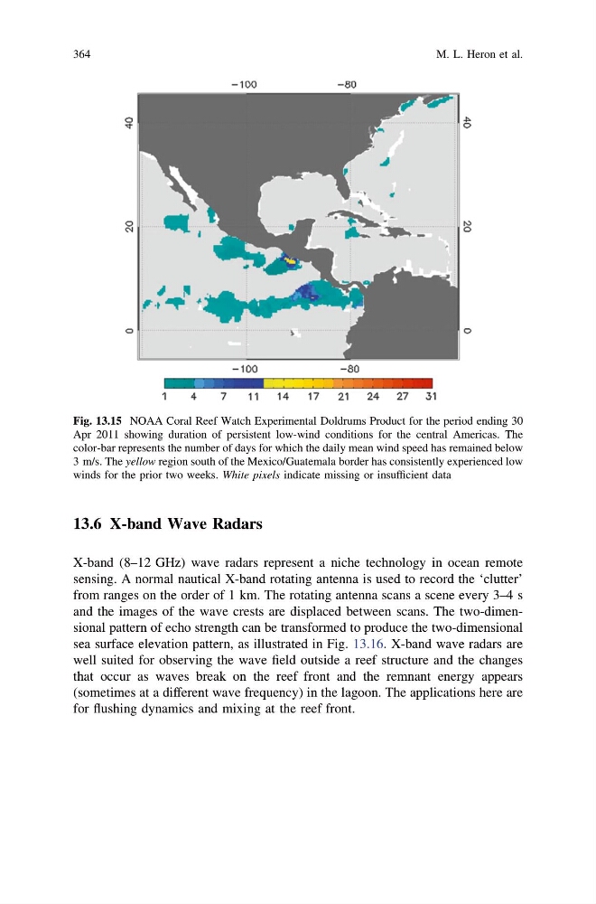
Fig. 13.15 NOAA Coral Reef Watch Experimental Doldrums Product for the period ending 30
Apr 2011 showing duration of persistent low-wind conditions for the central Americas. The
color-bar represents the number of days for which the daily mean wind speed has remained below
3 m/s. The yellow region south of the Mexico/Guatemala border has consistently experienced low
winds for the prior two weeks. White pixels indicate missing or insufficient data
364
M. L. Heron et al.
X-band (8–12 GHz) wave radars represent a niche technology in ocean remote
sensing. A normal nautical X-band rotating antenna is used to record the ‘clutter’
from ranges on the order of 1 km. The rotating antenna scans a scene every 3–4 s
and the images of the wave crests are displaced between scans. The two-dimensional pattern of echo strength can be transformed to produce the two-dimensional
sea surface elevation pattern, as illustrated in Fig. 13.16. X-band wave radars are
well suited for observing the wave field outside a reef structure and the changes
that occur as waves break on the reef front and the remnant energy appears
(sometimes at a different wave frequency) in the lagoon. The applications here are
for flushing dynamics and mixing at the reef front.
Fig. 13.15 NOAA Coral Reef Watch Experimental Doldrums Product for the period ending 30
Apr 2011 showing duration of persistent low-wind conditions for the central Americas. The
color-bar represents the number of days for which the daily mean wind speed has remained below
3 m/s. The yellow region south of the Mexico/Guatemala border has consistently experienced low
winds for the prior two weeks. White pixels indicate missing or insufficient data
364
M. L. Heron et al.