

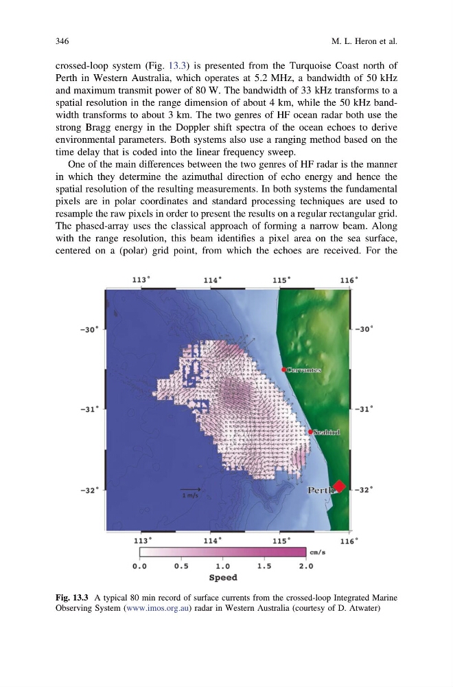
crossed-loop system (Fig. 13.3) is presented from the Turquoise Coast north of
Perth in Western Australia, which operates at 5.2 MHz, a bandwidth of 50 kHz
and maximum transmit power of 80 W. The bandwidth of 33 kHz transforms to a
spatial resolution in the range dimension of about 4 km, while the 50 kHz bandwidth transforms to about 3 km. The two genres of HF ocean radar both use the
strong Bragg energy in the Doppler shift spectra of the ocean echoes to derive
environmental parameters. Both systems also use a ranging method based on the
time delay that is coded into the linear frequency sweep.
One of the main differences between the two genres of HF radar is the manner
in which they determine the azimuthal direction of echo energy and hence the
spatial resolution of the resulting measurements. In both systems the fundamental
pixels are in polar coordinates and standard processing techniques are used to
resample the raw pixels in order to present the results on a regular rectangular grid.
The phased-array uses the classical approach of forming a narrow beam. Along
with the range resolution, this beam identifies a pixel area on the sea surface,
centered on a (polar) grid point, from which the echoes are received. For the
Fig. 13.3 A typical 80 min record of surface currents from the crossed-loop Integrated Marine
Observing System (www.imos.org.au) radar in Western Australia (courtesy of D. Atwater)
346
M. L. Heron et al.
Perth in Western Australia, which operates at 5.2 MHz, a bandwidth of 50 kHz
and maximum transmit power of 80 W. The bandwidth of 33 kHz transforms to a
spatial resolution in the range dimension of about 4 km, while the 50 kHz bandwidth transforms to about 3 km. The two genres of HF ocean radar both use the
strong Bragg energy in the Doppler shift spectra of the ocean echoes to derive
environmental parameters. Both systems also use a ranging method based on the
time delay that is coded into the linear frequency sweep.
One of the main differences between the two genres of HF radar is the manner
in which they determine the azimuthal direction of echo energy and hence the
spatial resolution of the resulting measurements. In both systems the fundamental
pixels are in polar coordinates and standard processing techniques are used to
resample the raw pixels in order to present the results on a regular rectangular grid.
The phased-array uses the classical approach of forming a narrow beam. Along
with the range resolution, this beam identifies a pixel area on the sea surface,
centered on a (polar) grid point, from which the echoes are received. For the
Fig. 13.3 A typical 80 min record of surface currents from the crossed-loop Integrated Marine
Observing System (www.imos.org.au) radar in Western Australia (courtesy of D. Atwater)
346
M. L. Heron et al.