

11.2.5 Thermal Validation
Validation of SST can be undertaken by comparison with in situ measurements. As
previously discussed, care must be taken when comparing measured temperatures
based upon their measurement technique (i.e., SST skin and SST subskin versus
SST bulk ; Fig. 11.5). Satellite SST products are often validated for broad patterns of
agreement with near-surface temperatures measured on deep-water buoys (e.g.,
Kilpatrick et al. 2001). However, to provide a like-for-like comparison, satellitederived temperature can be compared with temperature measured by a shipmounted radiometer (e.g., Minnett et al. 2001). An important element of sensor
calibration is to understand how the instrument responds at the specific channels
and how these responses change with time. As such, it is useful to maintain regular
validation of derived parameters (e.g., temperature). Chapter 12 provides a thorough discussion of temperature validation, particularly related to the monitoring of
coral reefs using currently available technology.
11.3 Radar Overview
11.3.1 Radar Physical Principles
Remote sensing of the ocean surface and the air-sea boundary region can be
carried out by measuring backscatter of transmitted (active) radar signals across a
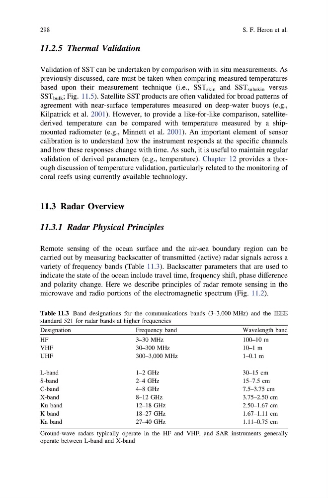
variety of frequency bands (Table 11.3). Backscatter parameters that are used to
indicate the state of the ocean include travel time, frequency shift, phase difference
and polarity change. Here we describe principles of radar remote sensing in the
microwave and radio portions of the electromagnetic spectrum (Fig. 11.2).
Table 11.3 Band designations for the communications bands (3–3,000 MHz) and the IEEE
standard 521 for radar bands at higher frequencies
Designation
Frequency band
Wavelength band
HF
3–30 MHz
100–10 m
VHF
30–300 MHz
10–1 m
UHF
300–3,000 MHz
1–0.1 m
L-band
1–2 GHz
30–15 cm
S-band
2–4 GHz
15–7.5 cm
C-band
4–8 GHz
7.5–3.75 cm
X-band
8–12 GHz
3.75–2.50 cm
Ku band
12–18 GHz
2.50–1.67 cm
K band
18–27 GHz
1.67–1.11 cm
Ka band
27–40 GHz
1.11–0.75 cm
Ground-wave radars typically operate in the HF and VHF, and SAR instruments generally
operate between L-band and X-band
298
S. F. Heron et al.
Validation of SST can be undertaken by comparison with in situ measurements. As
previously discussed, care must be taken when comparing measured temperatures
based upon their measurement technique (i.e., SST skin and SST subskin versus
SST bulk ; Fig. 11.5). Satellite SST products are often validated for broad patterns of
agreement with near-surface temperatures measured on deep-water buoys (e.g.,
Kilpatrick et al. 2001). However, to provide a like-for-like comparison, satellitederived temperature can be compared with temperature measured by a shipmounted radiometer (e.g., Minnett et al. 2001). An important element of sensor
calibration is to understand how the instrument responds at the specific channels
and how these responses change with time. As such, it is useful to maintain regular
validation of derived parameters (e.g., temperature). Chapter 12 provides a thorough discussion of temperature validation, particularly related to the monitoring of
coral reefs using currently available technology.
11.3 Radar Overview
11.3.1 Radar Physical Principles
Remote sensing of the ocean surface and the air-sea boundary region can be
carried out by measuring backscatter of transmitted (active) radar signals across a
variety of frequency bands (Table 11.3). Backscatter parameters that are used to
indicate the state of the ocean include travel time, frequency shift, phase difference
and polarity change. Here we describe principles of radar remote sensing in the
microwave and radio portions of the electromagnetic spectrum (Fig. 11.2).
Table 11.3 Band designations for the communications bands (3–3,000 MHz) and the IEEE
standard 521 for radar bands at higher frequencies
Designation
Frequency band
Wavelength band
HF
3–30 MHz
100–10 m
VHF
30–300 MHz
10–1 m
UHF
300–3,000 MHz
1–0.1 m
L-band
1–2 GHz
30–15 cm
S-band
2–4 GHz
15–7.5 cm
C-band
4–8 GHz
7.5–3.75 cm
X-band
8–12 GHz
3.75–2.50 cm
Ku band
12–18 GHz
2.50–1.67 cm
K band
18–27 GHz
1.67–1.11 cm
Ka band
27–40 GHz
1.11–0.75 cm
Ground-wave radars typically operate in the HF and VHF, and SAR instruments generally
operate between L-band and X-band
298
S. F. Heron et al.