

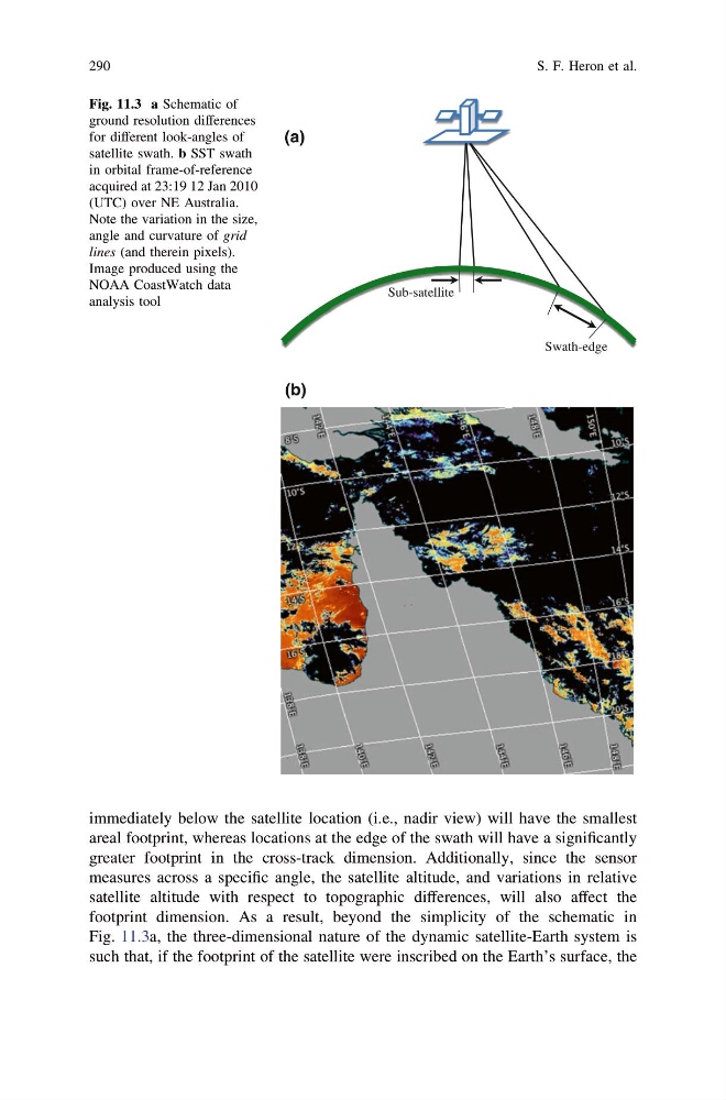
immediately below the satellite location (i.e., nadir view) will have the smallest
areal footprint, whereas locations at the edge of the swath will have a significantly
greater footprint in the cross-track dimension. Additionally, since the sensor
measures across a specific angle, the satellite altitude, and variations in relative
satellite altitude with respect to topographic differences, will also affect the
footprint dimension. As a result, beyond the simplicity of the schematic in
Fig. 11.3a, the three-dimensional nature of the dynamic satellite-Earth system is
such that, if the footprint of the satellite were inscribed on the Earth’s surface, the
Sub-satellite
Swath-edge
(b)
(a)
Fig. 11.3 a Schematic of
ground resolution differences
for different look-angles of
satellite swath. b SST swath
in orbital frame-of-reference
acquired at 23:19 12 Jan 2010
(UTC) over NE Australia.
Note the variation in the size,
angle and curvature of grid
lines (and therein pixels).
Image produced using the
NOAA CoastWatch data
analysis tool
290
S. F. Heron et al.
areal footprint, whereas locations at the edge of the swath will have a significantly
greater footprint in the cross-track dimension. Additionally, since the sensor
measures across a specific angle, the satellite altitude, and variations in relative
satellite altitude with respect to topographic differences, will also affect the
footprint dimension. As a result, beyond the simplicity of the schematic in
Fig. 11.3a, the three-dimensional nature of the dynamic satellite-Earth system is
such that, if the footprint of the satellite were inscribed on the Earth’s surface, the
Sub-satellite
Swath-edge
(b)
(a)
Fig. 11.3 a Schematic of
ground resolution differences
for different look-angles of
satellite swath. b SST swath
in orbital frame-of-reference
acquired at 23:19 12 Jan 2010
(UTC) over NE Australia.
Note the variation in the size,
angle and curvature of grid
lines (and therein pixels).
Image produced using the
NOAA CoastWatch data
analysis tool
290
S. F. Heron et al.