

DEM of 3 m bin-size resolution, as well as a 1 m resolution backscatter image of
the seafloor. These acoustic images, together with the images produced from the
SSS, were draped onto the DEMs. The backscatter images and DEMs were then
loaded in a GIS project and ‘overlaid’ by the submersible track coordinates, where
the timed submersible navigation tracks were fused with the timestamps of the
video footage. The bottom facies types discriminated from the submersible video
could then be correlated with the acoustic backscatter patterns observed on the
AUV maps. These maps were used to distinguish muddy sediments from coral
rubble and standing coral thickets for the mapped areas. Finally, the time and
coordinates of each bottom current measurement collected by the AUV were
plotted in the GIS project for spatial and temporal analyses.
The terrain, acoustic reflectivity pattern, sediment features, current regime, and
coral distribution recorded in these surveys varied significantly within and between
the two sites. In the site located on the GBB slope, for example, coral distribution
is associated with isolated, individual mounds (Fig. 10.1c). Here, mound morphometrics (i.e., quantitative analyses used to describe mound parameters) were
useful for identifying correlations between mound orientation and the prevailing
current direction. In contrast, corals of the slope of the Miami Terrace site are
related to low-relief ridges that cover a large part of the mapped area, and habitat
classification followed by terrain spatial analyses was applied to assess relationships between coral distribution and bottom currents. Although some of the differences between sites are visually apparent on the AUV maps, others are evident
only after systematic quantification of site attributes (e.g., mound footprint area
and coral distribution). The variables selected for quantification were determined
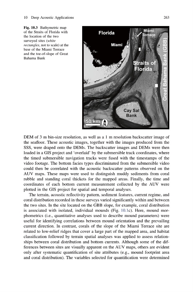
Fig. 10.3 Bathymetric map
of the Straits of Florida with
the location of the two
surveyed sites (white
rectangles, not to scale) at the
base of the Miami Terrace
and the toe-of-slope of Great
Bahama Bank
10 Deep Acoustic Applications
263
the seafloor. These acoustic images, together with the images produced from the
SSS, were draped onto the DEMs. The backscatter images and DEMs were then
loaded in a GIS project and ‘overlaid’ by the submersible track coordinates, where
the timed submersible navigation tracks were fused with the timestamps of the
video footage. The bottom facies types discriminated from the submersible video
could then be correlated with the acoustic backscatter patterns observed on the
AUV maps. These maps were used to distinguish muddy sediments from coral
rubble and standing coral thickets for the mapped areas. Finally, the time and
coordinates of each bottom current measurement collected by the AUV were
plotted in the GIS project for spatial and temporal analyses.
The terrain, acoustic reflectivity pattern, sediment features, current regime, and
coral distribution recorded in these surveys varied significantly within and between
the two sites. In the site located on the GBB slope, for example, coral distribution
is associated with isolated, individual mounds (Fig. 10.1c). Here, mound morphometrics (i.e., quantitative analyses used to describe mound parameters) were
useful for identifying correlations between mound orientation and the prevailing
current direction. In contrast, corals of the slope of the Miami Terrace site are
related to low-relief ridges that cover a large part of the mapped area, and habitat
classification followed by terrain spatial analyses was applied to assess relationships between coral distribution and bottom currents. Although some of the differences between sites are visually apparent on the AUV maps, others are evident
only after systematic quantification of site attributes (e.g., mound footprint area
and coral distribution). The variables selected for quantification were determined
Fig. 10.3 Bathymetric map
of the Straits of Florida with
the location of the two
surveyed sites (white
rectangles, not to scale) at the
base of the Miami Terrace
and the toe-of-slope of Great
Bahama Bank
10 Deep Acoustic Applications
263