

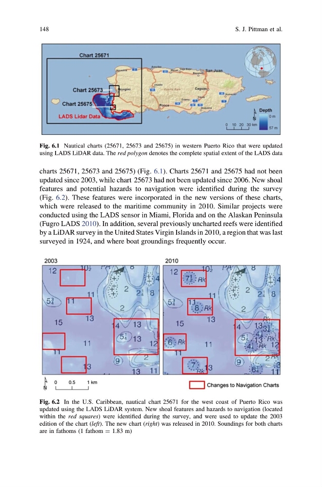
charts 25671, 25673 and 25675) (Fig. 6.1). Charts 25671 and 25675 had not been
updated since 2003, while chart 25673 had not been updated since 2006. New shoal
features and potential hazards to navigation were identified during the survey
(Fig. 6.2). These features were incorporated in the new versions of these charts,
which were released to the maritime community in 2010. Similar projects were
conducted using the LADS sensor in Miami, Florida and on the Alaskan Peninsula
(Fugro LADS 2010). In addition, several previously uncharted reefs were identified
by a LiDAR survey in the United States Virgin Islands in 2010, a region that was last
surveyed in 1924, and where boat groundings frequently occur.
Fig. 6.1 Nautical charts (25671, 25673 and 25675) in western Puerto Rico that were updated
using LADS LiDAR data. The red polygon denotes the complete spatial extent of the LADS data
Fig. 6.2 In the U.S. Caribbean, nautical chart 25671 for the west coast of Puerto Rico was
updated using the LADS LiDAR system. New shoal features and hazards to navigation (located
within the red squares) were identified during the survey, and were used to update the 2003
edition of the chart (left). The new chart (right) was released in 2010. Soundings for both charts
are in fathoms (1 fathom = 1.83 m)
148
S. J. Pittman et al.
updated since 2003, while chart 25673 had not been updated since 2006. New shoal
features and potential hazards to navigation were identified during the survey
(Fig. 6.2). These features were incorporated in the new versions of these charts,
which were released to the maritime community in 2010. Similar projects were
conducted using the LADS sensor in Miami, Florida and on the Alaskan Peninsula
(Fugro LADS 2010). In addition, several previously uncharted reefs were identified
by a LiDAR survey in the United States Virgin Islands in 2010, a region that was last
surveyed in 1924, and where boat groundings frequently occur.
Fig. 6.1 Nautical charts (25671, 25673 and 25675) in western Puerto Rico that were updated
using LADS LiDAR data. The red polygon denotes the complete spatial extent of the LADS data
Fig. 6.2 In the U.S. Caribbean, nautical chart 25671 for the west coast of Puerto Rico was
updated using the LADS LiDAR system. New shoal features and hazards to navigation (located
within the red squares) were identified during the survey, and were used to update the 2003
edition of the chart (left). The new chart (right) was released in 2010. Soundings for both charts
are in fathoms (1 fathom = 1.83 m)
148
S. J. Pittman et al.