

main street with width from 5 to 10 m. The only bigger buildings are palace-like
and located on the right side of Citadel’s new main entrance. Roofs of these
buildings were used as survey stations and as ground control points for aerial
imaging. A total of 16 survey stations and 600 detailed survey points were
measured.
On selected points, a GPS survey was conducted in order to transform the data
into geographic coordinates. A Trimble 5,000 total station with self-reflective laser
and GPS Trimble instruments were used for measurements. A geodetic point field
had been calculated and adjusted with a standard error of position m xy ¼ 20,32 mm,
with an average standard error of adjusted elevation m h ¼ 15,05 mm. These results
are sufficient for photogrammetric work and for following geodetic survey inside
the Citadel.
3.3.3.4 Data Evaluation and 3D Model Creation
The evaluation of available data and 3D model creation was performed using
intersection photogrammetry methods. Stereoscopy methods could not be used
due to the absence of perpendicular stereo pairs of the Citadel’s interior. Intersection photogrammetry is more time consuming than stereo photogrammetry because
it is necessary to find a single point on two or more oriented images and to ascertain
its image coordinates. When dealing with a smaller amount of detailed points and a
lower complexity of the objects as in the case of the Citadel’s building facades, this
work can be done with no difficulties. The only problem was the large number of
photographs, so high-performance computer technology had to be used. Before
final processing, photographs had to be categorized and only the best ones were
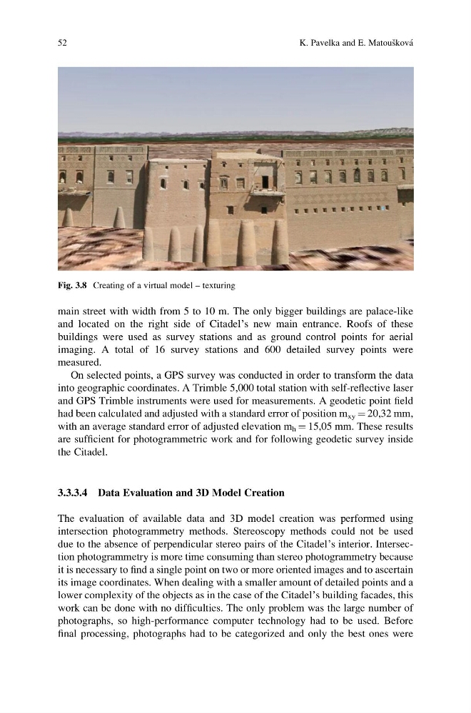
Fig. 3.8 Creating of a virtual model – texturing
52
K. Pavelka and E. Matous ˇkova ´
and located on the right side of Citadel’s new main entrance. Roofs of these
buildings were used as survey stations and as ground control points for aerial
imaging. A total of 16 survey stations and 600 detailed survey points were
measured.
On selected points, a GPS survey was conducted in order to transform the data
into geographic coordinates. A Trimble 5,000 total station with self-reflective laser
and GPS Trimble instruments were used for measurements. A geodetic point field
had been calculated and adjusted with a standard error of position m xy ¼ 20,32 mm,
with an average standard error of adjusted elevation m h ¼ 15,05 mm. These results
are sufficient for photogrammetric work and for following geodetic survey inside
the Citadel.
3.3.3.4 Data Evaluation and 3D Model Creation
The evaluation of available data and 3D model creation was performed using
intersection photogrammetry methods. Stereoscopy methods could not be used
due to the absence of perpendicular stereo pairs of the Citadel’s interior. Intersection photogrammetry is more time consuming than stereo photogrammetry because
it is necessary to find a single point on two or more oriented images and to ascertain
its image coordinates. When dealing with a smaller amount of detailed points and a
lower complexity of the objects as in the case of the Citadel’s building facades, this
work can be done with no difficulties. The only problem was the large number of
photographs, so high-performance computer technology had to be used. Before
final processing, photographs had to be categorized and only the best ones were
Fig. 3.8 Creating of a virtual model – texturing
52
K. Pavelka and E. Matous ˇkova ´