

84
Fig. 3a illustrates an environment much discussed in Sweden, the peri-urban areas
including urban sprawl. This environment is undergoing rapid change, with farmed
and grazed fields abandoned as a consequence of new land use; where people work
in towns or are employed by forestry instead of farming. Both squares are situated
in the mid/southern part of Sweden, and convey areas that were farmed in the 1980s
and are now road construction (No. 1), golf courses (No. 2) surrounded by nonmanaged grass/shrublands and non-used wooded grazing lands reverting to forest.
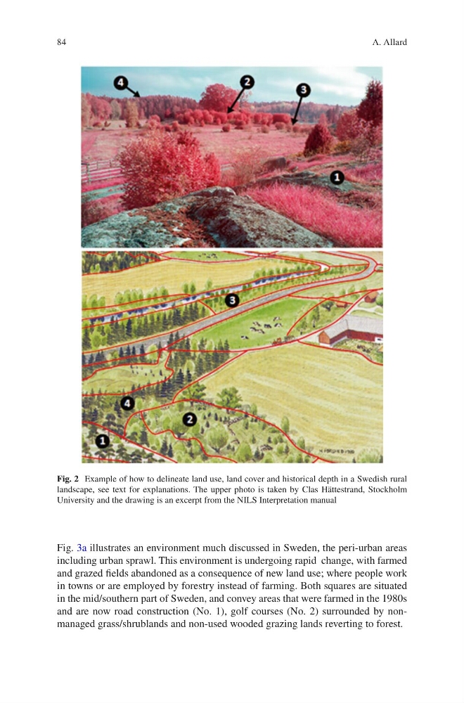
Fig. 2 Example of how to delineate land use, land cover and historical depth in a Swedish rural
landscape, see text for explanations. The upper photo is taken by Clas Hättestrand, Stockholm
University and the drawing is an excerpt from the NILS Interpretation manual
A. Allard
Fig. 3a illustrates an environment much discussed in Sweden, the peri-urban areas
including urban sprawl. This environment is undergoing rapid change, with farmed
and grazed fields abandoned as a consequence of new land use; where people work
in towns or are employed by forestry instead of farming. Both squares are situated
in the mid/southern part of Sweden, and convey areas that were farmed in the 1980s
and are now road construction (No. 1), golf courses (No. 2) surrounded by nonmanaged grass/shrublands and non-used wooded grazing lands reverting to forest.
Fig. 2 Example of how to delineate land use, land cover and historical depth in a Swedish rural
landscape, see text for explanations. The upper photo is taken by Clas Hättestrand, Stockholm
University and the drawing is an excerpt from the NILS Interpretation manual
A. Allard